Heavy Rainfall Forecast to Soak the South and East This Week While Florida Peninsula Stays Dry
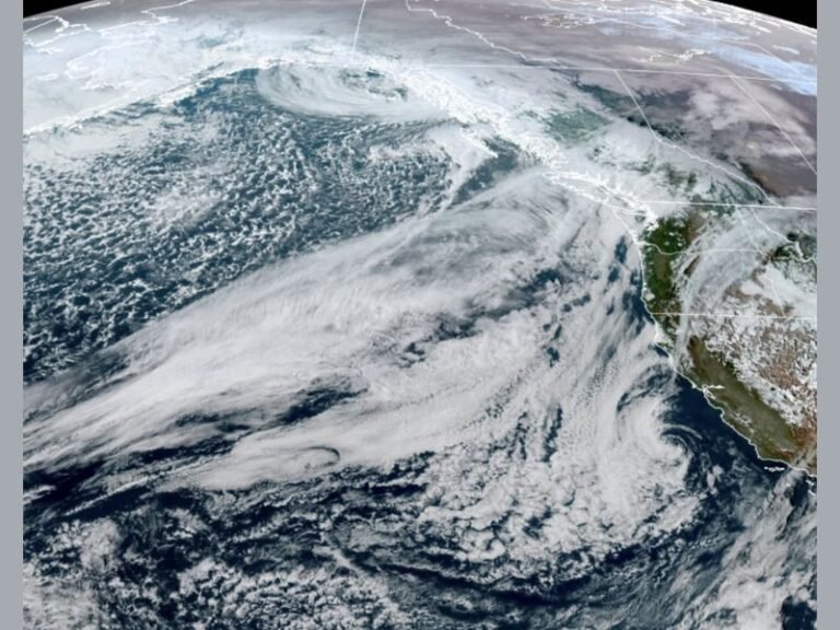
UNITED STATES — A broad zone of soaking rain is expected to develop across much of the Southern and Eastern United States this week, delivering multiple inches of precipitation to drought-affected areas along the Gulf Coast — but leaving much of Florida’s peninsula high and dry.
According to the NOAA Blend of Models, rainfall totals could exceed 4 to 5 inches in parts of Mississippi, Alabama, and northern Georgia by the end of the seven-day period. The heaviest precipitation is forecast between Saturday, November 29, and Saturday, December 6, as a series of low-pressure systems funnel Gulf moisture northward into the Southeast.
Gulf States Finally Get Needed Rain
The incoming rainfall will bring welcome relief to sections of the upper Gulf region, where several counties are still classified under D4-level drought — the most extreme category on the U.S. Drought Monitor.
Weather models show steady rain bands forming from Louisiana to Tennessee, producing totals between 2.5 and 5 inches across the region. The storm pattern is being driven by a strengthening La Niña setup, which has been pulling warm Gulf air into cooler frontal zones across the southern states.
“Juice is finally inching closer to parts of the upper Gulf that are in severe drought,” one forecaster noted. “These areas desperately need rain, and this week’s setup could help replenish soil moisture and water levels that have been at record lows.”
Florida Still Waiting for Relief
While much of the South will see days of rain, the Florida peninsula remains largely left out of this week’s wet pattern. Models predict minimal rainfall for central and southern Florida, where many communities have been enduring long-term dry conditions.
Some Florida residents have reported that local lake and reservoir levels are the lowest they’ve been in nearly two decades. The lack of widespread precipitation is expected to continue into early December, even as nearby states experience flooding rainfall.
Rainfall Breakdown by Region
The NOAA 7-day model indicates the following projected totals:
- Southern Mississippi and Alabama: 3–5 inches
- Northern Georgia and western Carolinas: 2–4 inches
- Tennessee and Kentucky: 1.5–3 inches
- Southern Illinois to Ohio Valley: 1–2 inches
- Florida Peninsula: Less than 0.5 inches
Localized flash flooding may occur in low-lying areas of Alabama, Mississippi, and northern Georgia, especially where the heaviest rainfall bands stall.
Weather Pattern Overview
Meteorologists attribute this active rain setup to repeated waves of Gulf moisture interacting with a horizontal jet stream pattern stretching across the South and lower Midwest. Each wave of energy will enhance rainfall potential as it tracks eastward toward the Atlantic Coast.
Meanwhile, drier air to the south will continue to suppress storm formation over most of Florida. Experts say it may take another shift in upper-level winds before the peninsula sees consistent rainfall again.
“This isn’t a one-and-done system,” a meteorologist explained. “We’re expecting the rain to come in multiple rounds through next week, which is great news for drought areas — but frustrating for regions still missing out, like central Florida.”
What to Expect Next
Residents across the Gulf and Southeast should prepare for steady rain, cooler temperatures, and possible flooding through midweek. Drivers are advised to watch for water-covered roads, especially in rural and low-elevation areas.
As the system exits by the end of next weekend, a brief dry window is expected before another wave of moisture likely returns mid-December.
Stay tuned for local forecast updates and rainfall coverage on SaludaStandard-Sentinel.com.