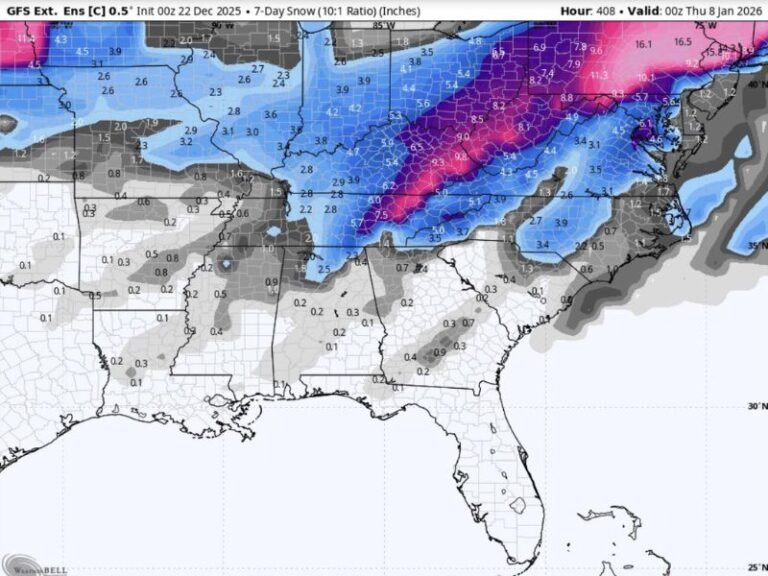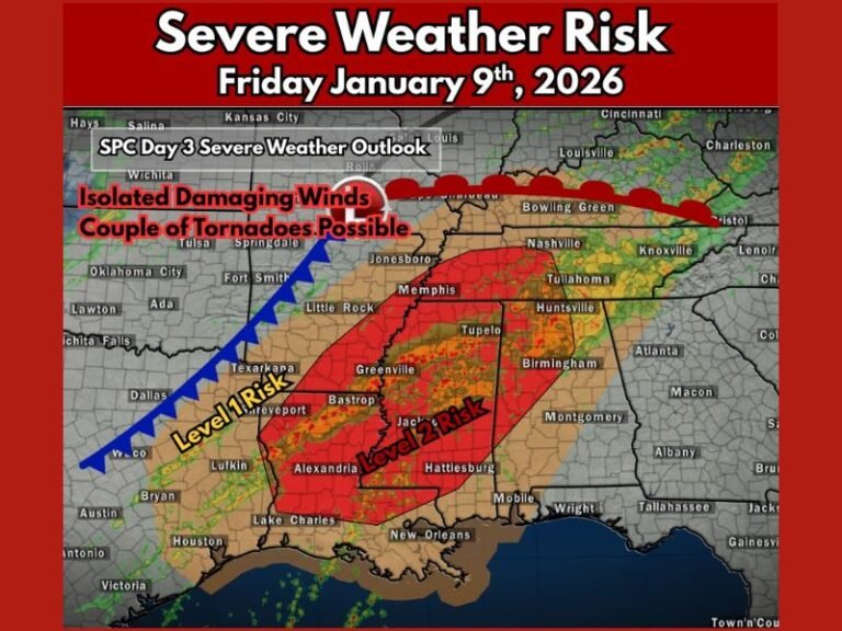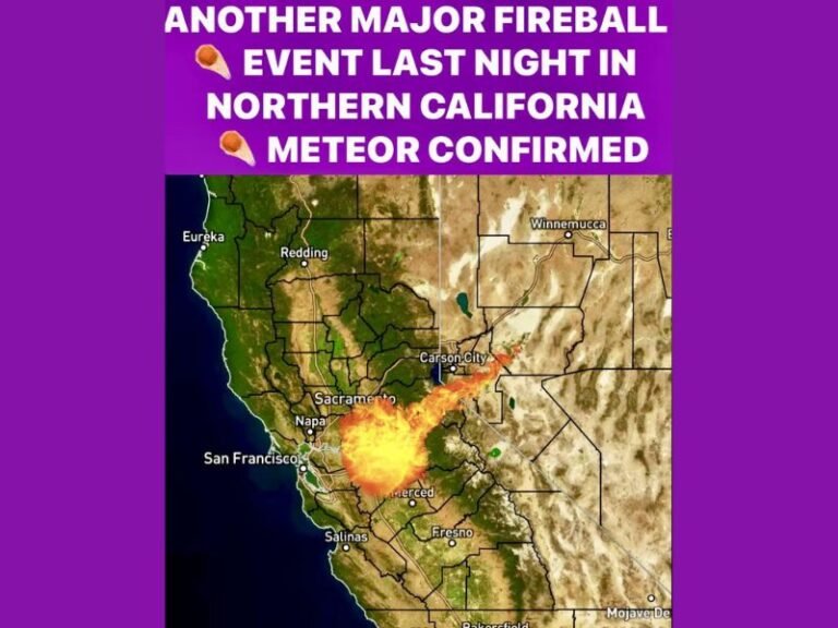
Heavy Rain Band Pushes South of I-4 in Florida, Radar Shows Downpours Targeting Tampa Bay to Sarasota and Bradenton
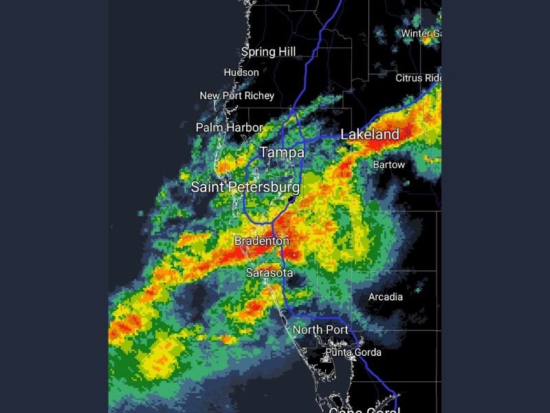
FLORIDA — A heavier band of rain is now pushing into areas south of I-4, with radar showing the most intense downpours lining up across the Tampa Bay region and stretching into parts of west-central Florida.
Where the Heaviest Rain Is Showing Up Right Now
Radar imagery shows a broad swath of rain covering the coastal corridor and nearby inland areas, with the strongest pockets focused from Tampa and St. Petersburg down toward Bradenton and Sarasota. The most intense cells appear embedded within the larger rain shield, meaning rainfall rates can jump quickly from steady rain to brief downpours.
Farther inland, heavier rain is also showing up near Lakeland and around Bartow, suggesting the wettest weather isn’t limited to the coast. Areas north of Tampa such as Palm Harbor and toward New Port Richey also appear to be seeing rain, but the most concentrated activity is clearly favoring the corridor south and southeast of the I-4 zone.
What This Could Mean for Travel and Neighborhood Impacts
When storms organize into a thicker, more continuous band like this, the biggest short-term issue is typically reduced visibility on roads and water collecting in low spots. Drivers should expect sudden heavy bursts that can make lanes hard to see, especially on major routes near Tampa Bay and along heavily traveled local roads between Bradenton and Sarasota.
If the heavier cells repeat over the same communities, localized street flooding can develop quickly even if there isn’t a formal flood warning in place.
Why This Rain Matters After Weeks of Dry Conditions
This rain is arriving at a time when many parts of Florida have been running behind on rainfall, so any steady soaking can help ease near-term dryness. That said, one round of rain usually does more to improve surface conditions than it does to fully reverse deeper deficits, especially if heavier totals stay confined to a narrow corridor.
What to Watch Over the Next Few Hours
The key question is whether the band continues to expand and hold together as it moves south and east. If it does, more neighborhoods could see periods of heavy rain rather than scattered showers.
Are you seeing downpours, lightning, or strong wind where you are? Share your location and what conditions look like in your area at SaludaStandard-Sentinel.com.