Gulf Coast Wind Event Forecast to Bring Strong, Hazardous Gusts Across Texas, Louisiana, Mississippi, Alabama, Georgia, and Florida
TEXAS — A widespread and potentially disruptive wind event is expected to impact large portions of the Gulf Coast region, beginning in Texas and extending eastward through Louisiana, Mississippi, Alabama, southern Georgia, and parts of northern Florida. Forecast guidance indicates a broad swath of strong surface winds developing as a powerful weather system moves across the southern United States.
Meteorological data suggests this will not be a routine breezy period. Instead, sustained winds combined with higher gusts could pose safety concerns, particularly in coastal and near-coastal communities where wind speeds are expected to peak.
Strong Wind Corridor Identified Across the Southern States
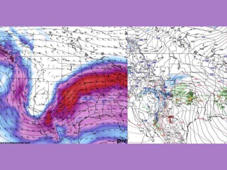
Forecast maps highlight a clearly defined corridor of enhanced wind speeds stretching from southern Texas across the central Gulf Coast. Blue-shaded regions on the data represent areas where the strongest winds are expected, especially during the morning through early afternoon hours.
As the system progresses eastward, the zone of strongest winds is forecast to expand into Louisiana, Mississippi, southern Alabama, southern Georgia, and the Florida Panhandle. While inland locations farther north may still experience gusty conditions, the most intense winds are expected closer to the Gulf Coast.
States and Regions Facing the Highest Wind Risk
Southern and coastal Texas are expected to experience the earliest impacts, with Louisiana following shortly after. Coastal Mississippi and Alabama are also positioned within the stronger wind band, while parts of southern Georgia and northwestern Florida may see similar conditions later in the day. These areas are particularly vulnerable due to open terrain and proximity to the Gulf, which allows winds to accelerate more efficiently. Localized variations are expected depending on terrain, vegetation, and urban development.
Potential Impacts From Strong and Gusty Winds
Wind events of this magnitude can result in downed tree limbs, unsecured objects becoming airborne, and scattered power outages. Temporary outdoor structures, construction materials, and lightweight equipment may be especially susceptible to damage. Travel conditions could also be affected, especially for high-profile vehicles such as trucks, vans, and recreational vehicles. Drivers crossing bridges or open highways may encounter sudden gusts capable of impacting vehicle control.
Meteorological Setup Behind the Wind Event
This wind event is being driven by a tightening pressure gradient between a departing low-pressure system and strengthening high pressure moving in behind it. As the atmosphere works to balance that pressure difference, air accelerates rapidly at the surface. This setup can generate widespread strong winds even without severe thunderstorms, making the event notable despite limited convective activity.
Safety and Preparedness Considerations
Residents across the impacted states are encouraged to secure loose outdoor items, remain alert to changing conditions, and use caution while traveling. Coastal and marine interests should be aware that rough conditions may develop quickly, especially during peak wind periods.
SaludaStandard-Sentinel.com will continue monitoring forecast updates and provide additional coverage if wind advisories or warnings are issued. Readers are encouraged to stay weather-aware and share local conditions as the event unfolds.