Greenville Forecast: Warm Start to Fall Before Storm Chances Arrive Late Week
GREENVILLE, N.C. — As fall officially begins Monday, eastern North Carolina residents can expect a warm and muggy start to the season, with highs in the 80s before unsettled weather develops later this week.
Warm Temperatures Continue
The National Weather Service in Newport/Morehead City reports that daily highs will stay in the low to upper 80s through midweek, with Greenville reaching 89°F on Tuesday. A slight cooling trend is expected by Friday as a front approaches.
Storm Chances Increase by Weekend
Shower and thunderstorm chances will rise beginning Thursday, with scattered storms likely Friday into Saturday and Sunday. Current forecasts show the highest rain potential on Friday at 50%, though conditions may shift as the system evolves.
Coastal Concerns: Rip Currents
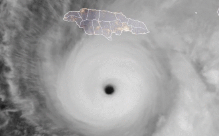
For coastal communities, the bigger concern comes from the ocean. Distant Hurricane Gabrielle is sending swells toward the North Carolina coast, raising the risk of dangerous rip currents through at least Tuesday. Beachgoers are urged to check safety flags and follow advisories if entering the water.
Looking Ahead
The unsettled weather pattern paired with high humidity will continue into early next week, keeping conditions damp and warm across inland and coastal counties.
Do you plan to enjoy the last stretch of summerlike warmth in Greenville, or will the coming storms change your weekend plans? Share your thoughts with us at SaludaStandard-Sentinel.com.