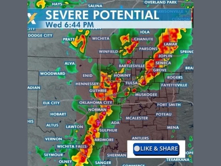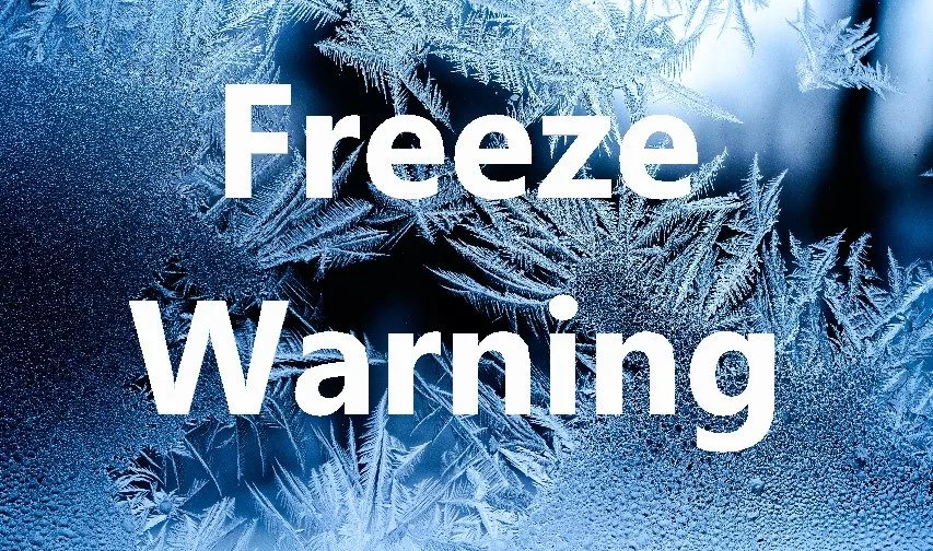
Freeze Warning in Effect for Pittsburgh Region, Ohio Valley, and West Virginia Mountains Tonight
PITTSBURGH, PENNSYLVANIA — The National Weather Service (NWS) in Pittsburgh has issued a Freeze Warning for parts of eastern Ohio and northern West Virginia, as another wave of cold, dry air brings widespread frost and freezing temperatures to the region overnight.
The warning will remain in effect from 2 a.m. to 9 a.m. Friday, with forecasters expecting overnight lows near 31°F and localized hard freezes in sheltered valleys.
Areas Affected Across the Ohio Valley
The advisory includes Muskingum, Guernsey, Noble, and Monroe counties in Ohio, as well as Preston and Tucker counties in West Virginia. Communities such as Zanesville, Cambridge, Caldwell, Woodsfield, Kingwood, and Parsons are all under the warning.
The NWS cautions that sub-freezing temperatures may kill crops and sensitive vegetation, potentially ending the growing season for many areas across the upper Ohio Valley and Appalachian foothills.
“Residents should take immediate steps to protect plants, pets, and plumbing from the cold,” officials said. “Even short periods of freezing temperatures can cause significant damage.”
Precautions for Residents
Meteorologists are advising residents to:
- Bring potted plants indoors or cover outdoor vegetation with protective cloths.
- Wrap exposed pipes or allow indoor faucets to drip slowly overnight to prevent freezing.
- Ensure outdoor pets have warm shelter and access to unfrozen water.
Experts also note that calm winds and clear skies will allow heat to escape rapidly overnight, creating prime conditions for frost formation in low-lying and rural areas.
Morning Chill Followed by Gradual Warm-Up
Forecasters expect temperatures to reach their lowest just before sunrise, with widespread frost developing across much of the affected region. The cold spell will ease by midmorning Friday as sunlight returns, lifting daytime highs into the mid-40s to low 50s under clear skies.
“This is typical for late October,” said NWS meteorologist Rachel Myers. “We’re transitioning out of fall warmth and into the early stages of winter-like conditions, especially in areas near the mountains.”
Seasonal Shift Across the Appalachians
The upcoming freeze marks another sign of the seasonal shift across the Ohio Valley and Appalachian regions, where cold mornings and frosty nights are becoming more frequent.
The NWS warns that while temperatures will rebound slightly during the day, additional frosts are likely through the weekend, particularly in valleys and sheltered mountain communities.
Outlook for the Weekend
A modest warming trend is expected beginning Saturday, with highs climbing into the upper 50s and low 60s, but nights will remain chilly under clear skies. No significant precipitation is forecast through the weekend.
Meteorologists say the pattern of clear, cold mornings followed by sunny, mild afternoons will continue into early next week before another cold front approaches.
Residents across the region are urged to stay informed about weather developments and take steps now to prepare for upcoming freezing nights as fall transitions into winter.
Have you noticed frost forming in your area? Share your local weather photos and updates with us at SaludaStandard-Sentinel.com.