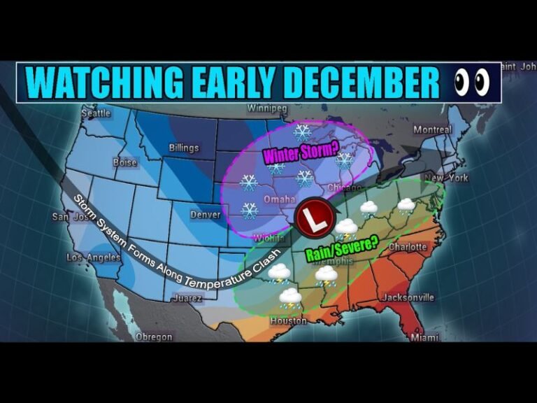
Forecast Models Show Potential for Accumulating Snow Across Oklahoma and North Texas Early Monday
OKLAHOMA CITY, OKLAHOMA — Meteorologists are closely monitoring new model data suggesting a potential winter weather event early Monday, with accumulating snow possible across northern Oklahoma and parts of North Texas.
While forecasts are still evolving, multiple models — including the European (EURO) model — now indicate measurable snowfall totals that could impact morning travel and kick off the first significant wintry system of the season in the Southern Plains.
Model Data Signals Early-Week Snowfall
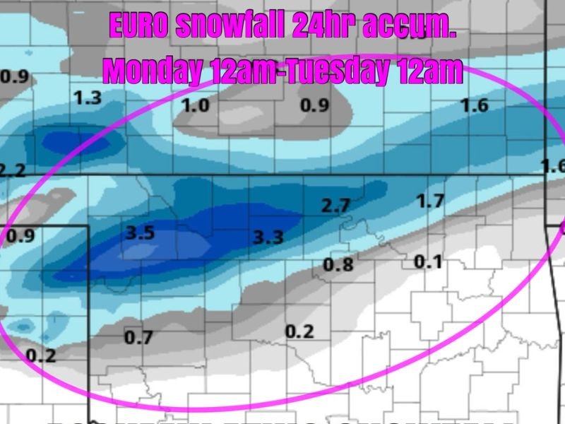
According to the latest EURO model run, snow could begin developing after midnight Sunday night, continuing through midday Monday before tapering off by early Tuesday morning.
Projected accumulations from the model show:
- 2 to 3.5 inches across parts of northern and northwestern Oklahoma
- 1 to 2 inches possible in central Oklahoma
- Light dustings extending south toward the Red River and parts of North Texas
Forecasters emphasize that these numbers are early projections and could shift as new data arrives over the weekend. However, the consistency between models is raising confidence that some form of winter precipitation is likely.
“This system is beginning to look more organized,” forecasters said Friday. “While it’s still too early to pinpoint exact totals, the setup supports a quick-moving band of snow early Monday that could briefly accumulate.”
Timing and Track Still Uncertain
The track of the developing upper-level disturbance will determine how far south the snow reaches and whether it transitions to a mix of sleet or freezing rain in some areas.
If the storm dips farther south, cities like Lawton, Ardmore, and Wichita Falls could see light flakes. A slightly more northern path would confine heavier snow to Woodward, Enid, and Ponca City.
Meteorologists will be watching for updates in the Saturday model runs, which are expected to give a clearer picture of the storm’s timing and intensity.
“We’ll be watching like a hawk,” one Oklahoma forecaster said. “Even a slight shift in temperature or trajectory can dramatically change where and how much snow falls.”
Impact on Monday Morning Travel
If current trends hold, snowfall could coincide with the Monday morning commute, especially in northern Oklahoma. Drivers are advised to be prepared for slick bridges, reduced visibility, and icy spots during the early hours.
Local officials and transportation departments are on alert, and road treatment crews may begin pre-treating major highways and interstates this weekend.
Residents across the region should:
- Monitor updated forecasts over the weekend
- Allow extra travel time Monday morning
- Check vehicle antifreeze and tire pressure before temperatures drop
First Winter System of the Season
This early-week snow potential follows a strong Arctic front that has already sent temperatures plunging across much of the central U.S. By Monday morning, temperatures in Oklahoma and North Texas will hover near or below freezing, creating ideal conditions for wintry precipitation to stick.
Forecasters say this could mark the first measurable snowfall of the season for many communities across the Texas Panhandle, western Oklahoma, and north-central Oklahoma.
While the system appears brief, it signals a shift toward a more active winter weather pattern in early December, with another cold wave expected to follow later in the week.
What’s Next
Meteorologists caution that exact snowfall totals may change as new data becomes available over the weekend. Updated short-range models will provide better insight into precipitation timing, intensity, and temperature profiles by Saturday night.
Residents are encouraged to stay tuned to local National Weather Service updates and regional forecasts through Monday morning for any advisories or winter weather warnings.
Stay with SaludaStandard-Sentinel.com for continuing coverage of this developing winter system and statewide cold weather impacts.