Florida Cold Front to Bring Widespread 0.5 to 1 Inch of Rain Across Tampa Bay Region, With Isolated Heavier Downpours Possible Overnight Into Monday
FLORIDA — A cold front pushing into the state will deliver a round of steady rain across the Tampa Bay region, with most communities expected to receive between half an inch and one inch of rainfall before the system clears.
Forecasters say locally heavier downpours are possible in a few spots, depending on where the strongest storms move onshore.
Most Areas Targeting Around One Inch of Rain
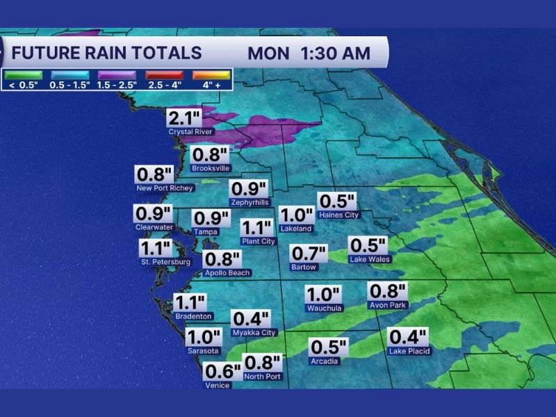
Future rainfall projections through early Monday morning show the majority of the region landing in the 0.50” to 1.00” range, with several communities clustered near the one-inch mark.
Projected totals include:
- Tampa: 0.9”
- St. Petersburg: 1.1”
- Clearwater: 0.9”
- Plant City: 1.1”
- Lakeland: 1.0”
- Sarasota: 1.0”
- Bradenton: 1.1”
- Zephyrhills: 0.9”
These totals indicate a fairly widespread soaking rain event rather than isolated, hit-or-miss showers.
Heavier Pocket Near Crystal River
One notable exception is near Crystal River, where projections show rainfall totals exceeding 2 inches (around 2.1”). This area could see more persistent or stronger cells moving through as the front progresses.
Meanwhile, some inland communities may receive slightly lower totals:
- Myakka City: 0.4”
- Lake Placid: 0.4”
- Arcadia: 0.5”
- Haines City: 0.5”
- Lake Wales: 0.5”
As always with frontal systems, exact totals will depend on where the strongest bands of rain set up.
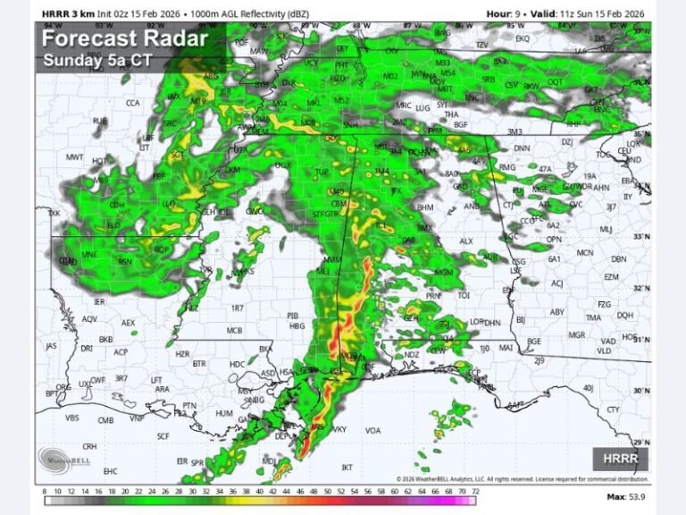
Timing: Overnight Into Early Monday
The heaviest rainfall is expected as the cold front pushes through overnight, with projections valid around 1:30 a.m. Monday. Rain will taper behind the front as drier air filters into the region.
Travel impacts should primarily involve wet roads and reduced visibility, especially during heavier downpours.
No Major Severe Weather Signal
The setup appears focused on rainfall rather than widespread severe storms. While brief gusty winds or isolated thunder can’t be ruled out, the main story is beneficial rainfall.
What This Means
For many communities, this event will provide:
- A solid half-inch to one-inch soaking rain
- Temporary ponding in low-lying spots
- Cooler, drier conditions following frontal passage
Residents should monitor updates throughout the day as exact rainfall bands become clearer. Stay with SaludaStandard-Sentinel.com for continuing weather coverage and local impact updates.