First Snow of the Season Expected Sunday Night Into Monday Across the South States
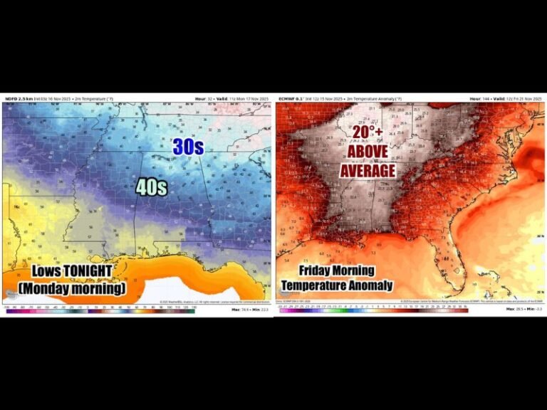
ASHEVILLE, N.C. — The first snowfall of the season is expected to arrive late Sunday night and continue into Monday morning across parts of the southern Appalachians, with light accumulations likely from middle Tennessee to western North Carolina.
Meteorologist Chris Nunley said a cold air system will move in behind a front, producing widespread flurries and light snow across portions of Tennessee, Alabama, Georgia, and the Carolinas.
Snowfall Expected Across Higher Elevations
Forecasters predict the heaviest snow will occur at elevations above 2,000 feet, where 1 inch or more of accumulation is possible. In the Great Smoky Mountains, totals could reach as high as 6 inches, particularly around Gatlinburg and Mount LeConte.
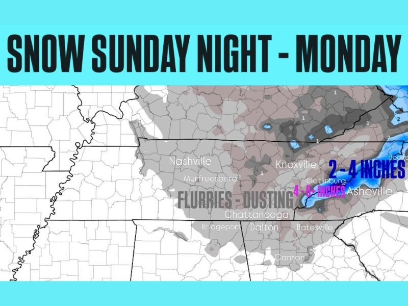
“Snow is likely Sunday night into Monday from middle Tennessee into northeast Alabama and north Georgia, as well as western North Carolina,” Nunley said in his latest forecast update. “For most areas, we’re talking about a dusting to light coating, but higher terrain could see several inches.”
Cities Likely to See Flurries or a Dusting
The snow event is expected to extend across Nashville, Knoxville, Chattanooga, Asheville, and Dalton, where residents could see light flurries overnight. Accumulations will vary depending on elevation and surface temperature.
- Middle Tennessee: Flurries to a light dusting
- North Georgia: Isolated snow showers in mountain areas
- Western North Carolina: 2 to 4 inches possible, with locally higher amounts up to 6 inches in the Smokies
Temperatures will drop into the low 30s and upper 20s overnight, raising the potential for slick spots on bridges and overpasses by early Monday morning.
Drivers Urged to Use Caution
Officials advise motorists traveling through the mountain regions late Sunday to exercise caution, especially in elevated areas where roads could become icy. Snow showers are expected to taper off by midday Monday as the system moves east.
Residents planning early commutes are encouraged to check local weather alerts and allow extra travel time in the morning.
Are you ready for winter’s first snowfall? Share your photos and local weather reports with us and follow more regional weather updates at SaludaStandard-Sentinel.com.