Eastern U.S. Braces for Dangerous Arctic Cold and Expanding Winter Storm Threat from Texas to Virginia
UNITED STATES — A developing Arctic outbreak is raising serious concerns across a large portion of the Eastern United States, as forecasters warn that dangerous cold temperatures and a potentially major winter storm could stretch from Texas through the Ohio Valley and into Virginia over the coming days.
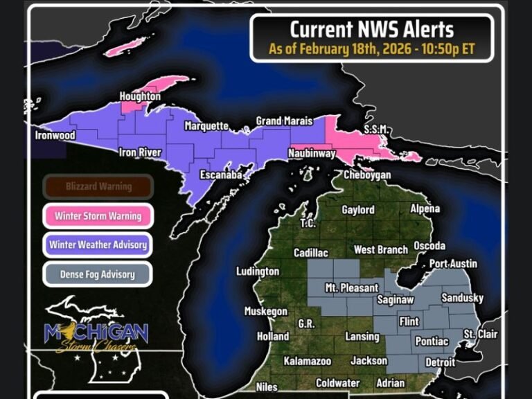
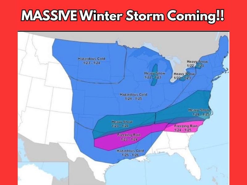
Forecast guidance highlighted by the National Weather Service shows a high-impact winter pattern setting up, with hazardous cold, heavy snow, and freezing rain all possible depending on storm track and timing.
Why This Weather Pattern Is Raising Red Flags
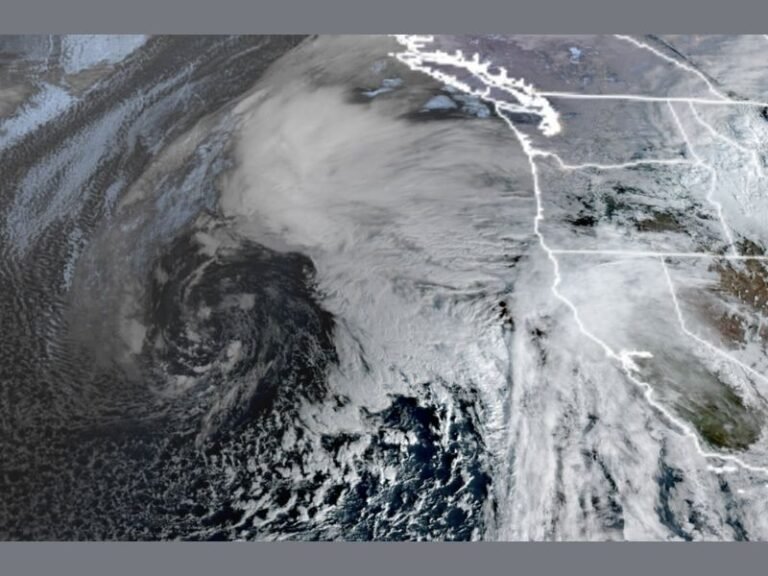
Meteorologists are closely watching a strong Arctic air mass pushing southward while moisture from the Gulf of Mexico rides over the top of the cold air. This setup creates a classic and dangerous winter storm environment, especially across the South and Mid-Atlantic.
Large areas of the central and eastern U.S. are already flagged for dangerous cold, with temperatures well below normal and wind chills capable of creating life-threatening conditions.
Potential Impacts by Region
Forecast maps indicate heavy snow potential from parts of Texas, Arkansas, Tennessee, Kentucky, and the Ohio Valley, with snowfall extending into portions of the Mid-Atlantic.
A corridor of freezing rain is also possible from North Texas through the Deep South and into parts of the Southeast, including areas of Louisiana, Mississippi, Alabama, Georgia, and Virginia. Ice accumulation poses a serious risk for power outages, downed trees, and dangerous travel.
Meanwhile, much of the broader region — including the Plains, Midwest, and South — could experience hazardous cold lasting several days, with the coldest air spreading east late in the period.
What Makes This Storm Especially Concerning
Forecasters note that impacts range from moderate to potentially major, depending on how the storm evolves. Even small shifts in temperature or storm track could dramatically change who sees snow versus ice — a critical factor for travel safety and infrastructure.
The cold alone presents a significant hazard, particularly for vulnerable populations, pets, livestock, and anyone without reliable heating.
Timing and Uncertainty Still Remain
While confidence is increasing that a significant winter weather event is possible, exact impacts are not yet locked in. The most likely window for the storm appears to be late week into the weekend, with the cold lingering even after precipitation ends.
Residents across the affected states are urged to prepare now, monitor trusted forecasts, and avoid relying on sensational or unverified weather claims.
How to Prepare Ahead of Time
Preparation should include ensuring heating systems are working, protecting pipes from freezing, limiting unnecessary travel, and having emergency supplies ready in case of power outages or hazardous road conditions.
Winter is far from finished, and this developing pattern could deliver one of the more impactful cold-and-storm combinations of the season. Have you already begun preparing for the cold and potential winter storm? Share your thoughts and stay informed with continued updates from SaludaStandard-Sentinel.com.