East Coast Winter Storm Threat Escalates as Developing Bomb Cyclone Signals Snow, High Winds, and Possible Blizzard Conditions This Weekend
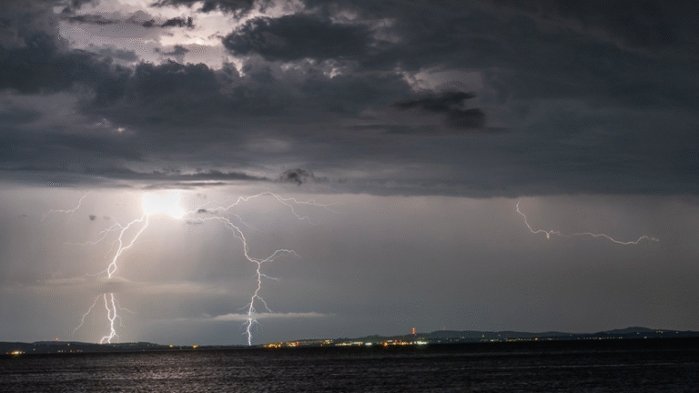
UNITED STATES — A rapidly evolving winter storm setup is raising concern along much of the East Coast as meteorologists warn that a developing bomb cyclone could deliver widespread winter weather impacts this weekend, including accumulating snow, powerful winds, and the potential for blizzard conditions in some areas.
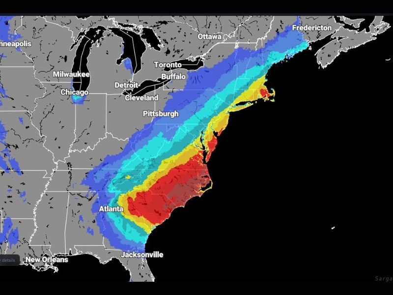
Forecast guidance shows a high probability of at least minor winter storm impacts from the Southeast through the Mid-Atlantic and into New England, with the threat intensifying where snow bands and strongest winds overlap.
Bomb Cyclone Development Drives Growing Concern
At the center of the forecast is a rapidly deepening low-pressure system expected to intensify offshore, a process known as bombogenesis. This occurs when surface pressure drops sharply in a short period of time, dramatically strengthening the storm.
As the low deepens, it is forecast to pull cold air southward while drawing Atlantic moisture inland, creating a classic setup for heavy snow on the storm’s northwest side and strong, damaging winds closer to the coast.
Snow and Wind Overlap Could Create Blizzard Conditions
Where snow coincides with increasing wind speeds, forecasters say blizzard or near-blizzard conditions may develop. Even moderate snowfall rates can become dangerous when combined with gusty winds, leading to whiteout conditions, drifting snow, and rapidly deteriorating travel.
The highest risk zones appear to stretch from parts of the Southeast coastal plain northward through the Mid-Atlantic and into portions of New England, depending on the final track of the storm.
Southeast to Mid-Atlantic Faces Mixed but Impactful Weather
Across the Southeast, including parts of Georgia, the Carolinas, and coastal Virginia, precipitation type and intensity will depend heavily on storm track and thermal profiles. Some areas may see snow or a wintry mix, while others experience cold rain paired with strong winds.
Even locations that do not receive snow could face hazardous conditions due to gusty winds, falling temperatures, and rapidly changing road conditions.
Northern Impacts Increase Toward the Northeast
Farther north, colder air already in place raises the likelihood of snow as the system strengthens. As the storm lifts northeastward, impacts are expected to increase, with the potential for heavier snowfall rates and stronger winds across parts of the Mid-Atlantic and New England.
Forecasters stress that small shifts in storm track could significantly alter snowfall totals and impact zones, making upcoming forecast updates critical.
What Residents Should Prepare For
While exact details remain uncertain, the overall signal is clear: a high-impact winter storm is increasingly likely somewhere along the East Coast this weekend. Residents are encouraged to monitor forecasts closely, prepare for hazardous travel, and be ready for possible power disruptions where winds intensify.
Confidence will continue to increase as the storm system comes into sharper focus over the next 24 to 48 hours. Have you begun preparing for this potential winter storm, or are you already seeing impacts where you live? Share your observations and stay informed with continued updates from SaludaStandard-Sentinel.com.