Deep South Faces Sharp Winter Reversal on January 18 as Temperatures Drop 20–30 Degrees Below Normal Across Alabama, Georgia, and Tennessee
ALABAMA — A brief stretch of spring-like warmth across the Deep South is expected to end abruptly as a significant cold air surge returns by January 18, bringing temperatures 20 to 30 degrees below normal to large portions of the region. Forecast data shows a pronounced temperature anomaly developing overnight, signaling a return to true winter conditions after several days of misleading mild weather.
Temporary Warmth Will End Quickly
Weather pattern analysis indicates the current mild stretch is not the end of winter, but rather a short-lived interruption. Cold air that has temporarily retreated is forecast to re-enter the region with force, driven by a strong north-to-south push that will drop temperatures rapidly after late evening hours. By the night of January 17 into early January 18, temperatures are expected to fall sharply, particularly after 11 p.m., when cold air begins sliding southward in a more aggressive pattern.
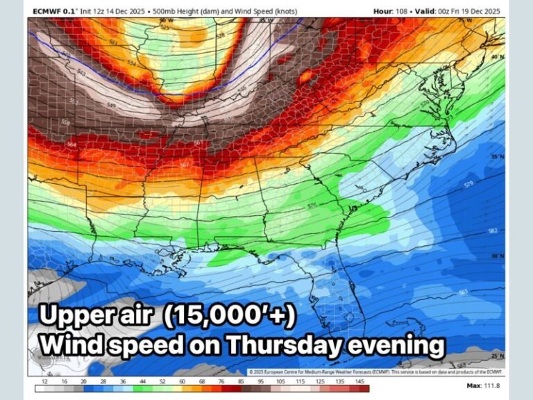
Temperature Anomaly Map Signals Real Winter Return
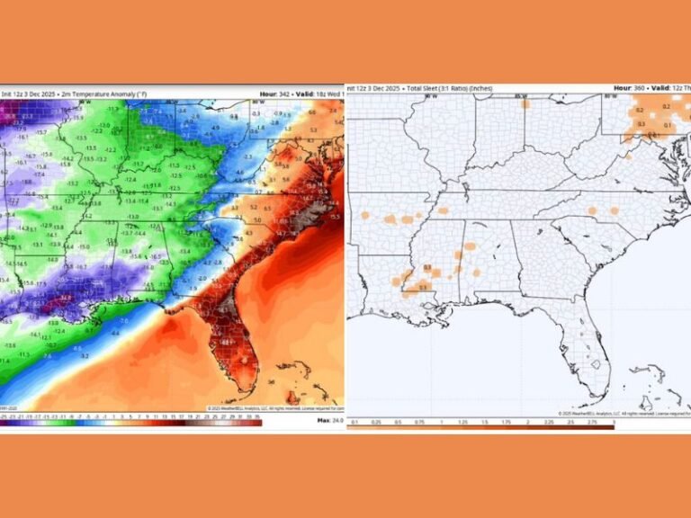
The temperature anomaly map highlights a large pocket of deep blue and purple shading centered over Alabama, extending into Georgia and Tennessee.
These colors represent departures of 20 to nearly 30 degrees below seasonal averages, a signal of a well-organized cold intrusion rather than a minor cool down. Northern and central Alabama appear to be near the core of this anomaly, with surrounding states experiencing slightly less intense but still significant cold.
Wind and Overnight Conditions Will Increase Cold Impact
In addition to falling temperatures, winds are expected to shift and increase, adding to the uncomfortable conditions. Cold air moving sideways rather than gradually settling will make the drop feel sudden and intrusive, especially inside homes as heating systems work overtime. Residents may notice clicking pipes, fluctuating indoor temperatures, and drafty conditions, all indicators of a sharp external temperature change.
Cold Will Affect Daily Routines
The expected cold snap is not typical jacket weather, particularly overnight and during early morning hours. Standing near heat sources, adjusting thermostats frequently, and layering clothing will become necessary again after several days of lighter attire. Even short periods outdoors could feel noticeably colder than earlier in the week, especially with wind chill factored in.
Why This Pattern Matters
Forecasters emphasize that this setup reflects winter reasserting itself, not a random fluctuation. The pattern supports sustained cold rather than a single chilly morning, meaning the effects could linger beyond January 18 before temperatures gradually recover. This type of reversal is common during mid-winter, especially following brief warm spells that allow cold air to rebuild and surge southward.
What Residents Should Prepare For
Residents across the affected states should prepare for a rapid return to winter conditions, particularly overnight. Layering clothing, checking heating systems, and securing outdoor items ahead of the temperature drop can help reduce discomfort when the cold arrives. While no winter precipitation is indicated in the data provided, the temperature shift alone will be impactful, especially for those who have adjusted to recent warmth.
As the map clearly indicates, fake spring ends and real winter resumes on January 18, with cold air returning decisively across the Deep South. Readers are encouraged to share how conditions change in their area and stay updated through SaludaStandard-Sentinel.com as this winter pattern develops.