Colorado, Wyoming and Nebraska Face Passing Cold Front With Light Showers, Cooler Temperatures and Isolated Thunderstorm Chances Into Midweek
COLORADO — A shifting weather pattern across parts of the central Rockies and High Plains is expected to bring light showers, cooler temperatures, and a few isolated thunderstorms as a cold front moves through the region.
The system will impact areas across Colorado, Wyoming, and Nebraska, with conditions gradually changing from mild and slightly unsettled to cooler and more stable behind the front.
Light Showers and Clouds Develop Ahead of Cold Front
Residents across Colorado and nearby regions may notice increasing cloud cover along with a few light showers during the evening hours.
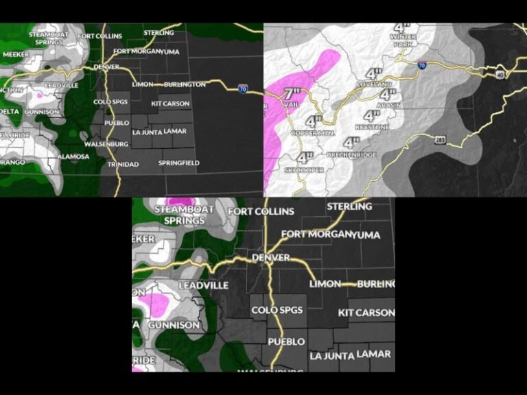
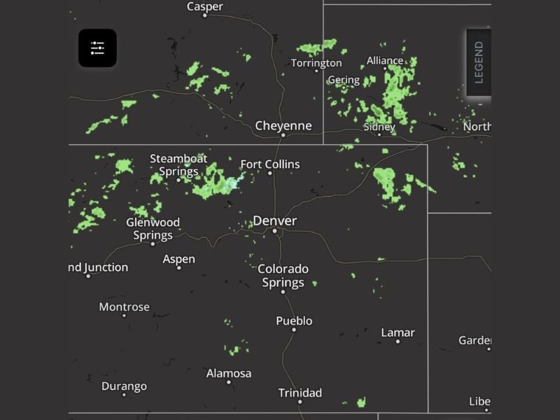
These showers are expected to remain scattered and generally light, with no significant impacts anticipated during this initial phase. Radar trends show spotty precipitation across areas including Denver, Fort Collins, and extending northward into Wyoming and Nebraska.
Cold Front Moves Through Late Morning Into Afternoon
The main change arrives as a cold front pushes through late morning into early afternoon, bringing a noticeable shift in wind direction. Winds will turn out of the north and northeast behind the front, allowing cooler air to move into the region. This transition will lead to a drop in temperatures compared to previous days, signaling a brief return to more typical conditions for this time of year.
Northern Areas of Wyoming and Nebraska See Overnight Passage
The cold front is expected to move through northern portions of Wyoming and Nebraska during the overnight hours.
This timing means some areas could experience changing conditions late at night, including cooler air and lingering cloud cover. While impacts are expected to remain minimal, the overnight passage could bring a noticeable shift by the following morning.
Showers and Isolated Thunderstorms Increase Into Afternoon and Evening
As the day progresses, chances for showers will increase, with a few isolated thunderstorms possible during the afternoon and evening hours.
These storms are not expected to become severe but could bring brief periods of rain and localized gusty winds. Coverage will remain scattered, meaning not all areas will see rainfall.
Cooler Conditions Set In Following Front Passage
Once the front moves through, cooler temperatures will settle across the region, replacing the milder air that was in place earlier. This change will be accompanied by continued cloud cover and occasional showers, especially in areas where moisture lingers behind the boundary.
The overall pattern suggests a calmer but cooler stretch of weather heading into midweek. Stay informed and share your local conditions or experiences by visiting SaludaStandard-Sentinel.com.