Colorado, New Mexico and Arizona Could See Wetter Monsoon While Midwest States Face Drier Conditions as El Niño Strengthens Toward Summer and Winter
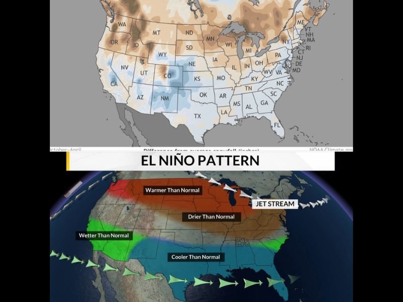
UNITED STATES — A strengthening El Niño pattern is increasingly expected to shape weather conditions across the country in the coming months, with impacts ranging from wetter conditions in the Southwest to drier trends across parts of the Midwest.
Forecast signals suggest that this developing pattern could not only influence summer weather but also extend into fall and winter, bringing noticeable regional differences in precipitation, temperature, and storm activity.
Southwest States Could See Increased Rainfall and Monsoon Activity
States such as Arizona, New Mexico, and parts of Colorado are likely to benefit from enhanced moisture as El Niño strengthens. This pattern typically supports a more active monsoon season across the desert Southwest, especially during July and August.
Increased atmospheric moisture and storm activity could lead to above-normal rainfall in these areas, helping to offset dry conditions while also raising the potential for localized flooding during stronger storm events. This moisture surge may even extend into parts of southern Colorado, influencing summer rainfall patterns across the region.
Midwest and Northern States Trending Warmer and Drier
In contrast, states across the Midwest including Illinois, Indiana, Wisconsin, and parts of Michigan are expected to trend warmer and drier than normal under this pattern.
The typical El Niño setup shifts the jet stream farther north, limiting storm activity across these regions and reducing overall precipitation. This could lead to prolonged dry spells, particularly during key parts of the growing season.
While not extreme on its own, the consistency of this pattern can gradually increase drought concerns if rainfall remains limited over time.
Southern U.S. May See Cooler and More Active Conditions
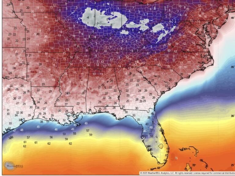
Across the southern tier of the United States, including Texas, Louisiana, Mississippi, Alabama, and Florida, El Niño often brings cooler-than-normal temperatures along with increased storm activity.
This region may see more frequent rainfall events compared to the Midwest, particularly as moisture from the Gulf of Mexico interacts with the altered jet stream pattern.
The balance between cooler temperatures and increased precipitation could create a more active weather setup across the southern states during parts of the year.
Colorado Outlook Shows Mixed Seasonal Impacts
Colorado sits in a transitional zone within the El Niño pattern, meaning impacts can vary depending on the time of year and strength of the system.
During summer, conditions are expected to remain near normal overall, though increased monsoon activity could bring periodic bursts of rain, particularly across southern and central areas.
By winter, historical data suggests that parts of Colorado — including the Front Range and eastern plains — could see above-average snowfall, while western areas may trend drier than usual.
Severe Weather Signals May Increase During Transition
Another important aspect of this evolving pattern is a potential increase in severe weather activity during the transition phase from La Niña to El Niño.
While not guaranteed, historical trends show that spring and early summer periods during this shift can feature more frequent severe weather events, particularly across the central United States.
This includes the possibility of stronger thunderstorms, increased wind events, and isolated tornado risks depending on how atmospheric conditions align.
Pattern Strength Will Determine Final Impacts
Despite growing confidence in the development of El Niño, forecasters emphasize that no two events behave exactly the same. The overall strength of the system will play a major role in determining how pronounced these impacts become.
A stronger El Niño could amplify wet and dry extremes across different regions, while a weaker event may produce more subtle changes.
As more data becomes available in the coming weeks, forecast details will continue to evolve, providing clearer insight into how this pattern will shape weather across the United States.
Are you noticing early signs of changing weather patterns in your area? Share your observations with us at SaludaStandard-Sentinel.com and join the conversation.