Cold Weather Pattern to Return Across Texas, Oklahoma, Arkansas, Louisiana, Mississippi, Alabama, Georgia, and the Carolinas During New Year’s Week
UNITED STATES — A significant flip back to colder conditions is expected across much of the South and Southeast as we move into New Year’s Week, ending the unusually warm, humid, and fog-heavy stretch that has dominated the region ahead of Christmas.
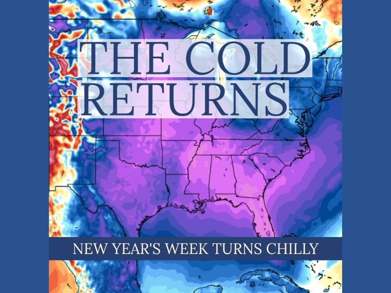
Forecast models show a widespread push of seasonal to below-normal temperatures expanding from Texas and Oklahoma through Arkansas, Louisiana, Mississippi, Alabama, Georgia, Tennessee, and into both Carolinas, bringing frost and freeze potential back into the forecast for the first week of January.
Warm, Humid Pattern Coming to an End
For much of December, the South has been locked in an unseasonably warm pattern, with widespread 60s, 70s, and even pockets of 80-degree warmth in parts of the Gulf states. Humidity, fog, and stagnant air have been common as a persistent ridge kept colder air bottled up to the north.
That pattern is finally breaking down. Meteorologists expect a stronger northern jet stream to dip southward, allowing cooler Canadian air to move into the central and eastern United States beginning late next week.
What the New Pattern Looks Like
According to early temperature-anomaly projections, the shift will not bring extreme or dangerous cold, but instead a quick transition to more typical wintertime chill, including:
- Overnight frost or freeze potential
- Daytime highs returning to more seasonal levels
- A reduction in humidity and fog
- A stronger northwest flow bringing clearer, drier air
The coldest air appears likely to settle from Texas through the Deep South and northeastward into the Carolinas, with broad purple and blue shading on forecast maps signaling a solid cool-down for the entire region.
Timing of the Change
The shift is projected to begin in about a week, with the most noticeable cooling arriving just after New Year’s Day. Temperatures will drop quickly behind a remapping of the upper-level pattern, ending the unusually warm run that has lasted much of December.
Though this does not look like a severe Arctic outbreak, the transition will be significant enough to bring early-January frost and freeze risks back into play across the South.
Looking Ahead
Forecasters note that more changes could follow in early January depending on jet stream behavior. If the northern branch remains active, additional cold fronts may reinforce the chill and possibly set up a stormier pattern.
For now, residents across the South should prepare for a return to more seasonal winter temperatures, a noticeable contrast from the recent warm spell. For continuing updates on weather impacts across the region, visit SaludaStandard-Sentinel.com.