Coastal Flood Watch Issued for Eastern North Carolina Through Friday
NEWPORT, NORTH CAROLINA – The National Weather Service (NWS) Newport/Morehead City has issued a coastal flood watch for parts of Eastern North Carolina, effective from Tuesday at noon until Friday at 8 a.m. .
Areas Under the Watch
The advisory covers:
- East Carteret
- Northern Outer Banks
- Ocracoke Island
- Hatteras Island
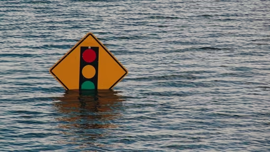
Officials warn these areas could experience significant oceanside inundation, leaving some coastal roads impassable for several days .
Severe Threats Expected
The NWS cautioned that the event could bring:
- Extreme beach and coastal damage
- Severe flooding inland from waterfronts
- Destruction of protective dune structures
- Impassable roads and submerged vehicles
- Dangerous rip currents and surf conditions
Residents are urged to take action now to protect life and property.
Safety Guidance from NWS
The NWS emphasized several safety measures:
- Avoid driving through floodwaters or around barricades.
- Move to higher ground immediately if in a flood-prone area.
- Stay out of water that could be electrified.
- Remember that 6 inches of moving water can knock a person off their feet and 12 inches can sweep away most vehicles .
Hydroplaning Hazards
The agency also warned drivers about hydroplaning, which occurs when vehicles lose traction on wet roads. To reduce risk:
- Drive at reduced speeds.
- Avoid deep water and standing puddles.
- Ensure tires have proper tread depth.
If a vehicle starts hydroplaning, drivers should ease off the accelerator, turn into the skid, and gently brake until control is regained .
For continuous weather alerts, coastal updates, and safety resources across North Carolina, follow SaludaStandard-Sentinel.com.