Central North Carolina Weather Alert: Raleigh Faces Friday Afternoon Storm Threat
RALEIGH, N.C. — The National Weather Service is warning residents in central North Carolina to brace for potentially severe thunderstorms Friday afternoon, with the highest risk window beginning after 2 p.m. According to the Country Herald, storms could bring heavy rainfall, hail, and wind gusts up to 30 mph, increasing the potential for localized flash flooding in low-lying and urban areas.
Peak Risk Friday Afternoon
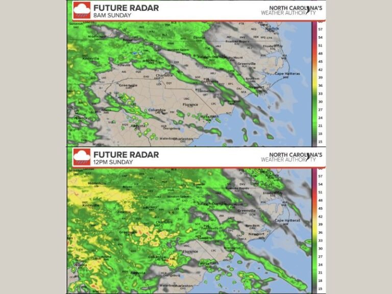
Forecasters expect the most active storm period to stretch from mid-afternoon into early evening. Major travel corridors including I-40, I-440, and U.S. 1 may experience slowed traffic and reduced visibility during intense downpours.
School sporting events and outdoor gatherings could face last-minute cancellations or delays as storm cells move through the region. Officials are urging event organizers and residents to keep a close eye on weather alerts.
Weekend and Early Week Outlook
While the threat of severe weather diminishes on Saturday, forecasters say isolated afternoon thunderstorms remain possible through Tuesday. Saturday’s forecast calls for partly sunny skies with a chance of late-day storms, followed by sunny and warm conditions on Sunday. By Monday, the region could see a slight chance of scattered storms again.
Safety Precautions
Authorities are reminding residents to secure outdoor items that could become airborne in strong winds and to avoid driving through flooded roadways, where water depth can be deceptive and dangerous.
A further update on storm timing and severity is expected late Thursday night as meteorologists refine their models.
Do you plan to adjust your weekend plans because of Friday’s storm threat? Share your thoughts and experiences with us at SaludaStandard-Sentinel.com.