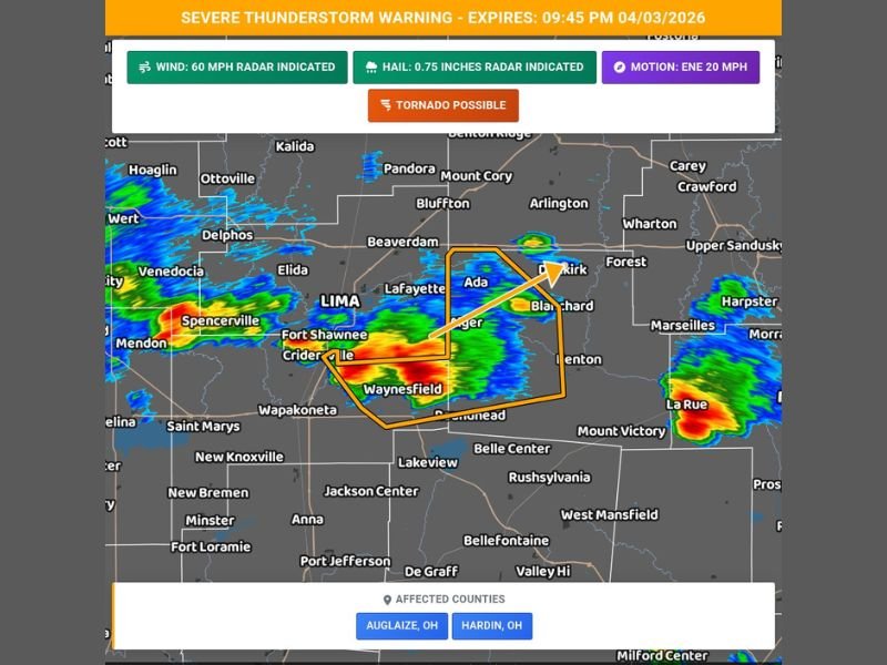
Auglaize and Hardin Counties in Ohio Hit by Severe Thunderstorm Near Waynesfield With 60 MPH Winds, Hail and Tornado Concern
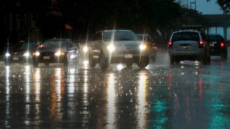
OHIO — A severe thunderstorm that moved across portions of Auglaize and Hardin counties Friday evening brought strong winds, hail, and a brief tornado concern before the warning expired at 9:45 PM EDT.
The storm, which was located near Waynesfield, tracked east at approximately 25 mph and intensified as it moved through the region, impacting communities along and near the I-75 corridor.
Strong Winds and Hail Highlighted During Active Warning
During the peak of the warning, radar indicated wind gusts reaching up to 60 mph along with penny-sized hail. These conditions posed a risk for localized damage, particularly to trees and power lines across the warned counties.
Communities including Wapakoneta, Ada, and areas near Kenton were directly in the storm’s projected path as it advanced eastward. Drivers along Interstate 75 near mile marker 118 were specifically warned about rapidly changing conditions.
Tornado Potential Added Urgency to Warning
In addition to wind and hail threats, the storm carried a “tornado possible” tag, increasing concern for residents in its path. While no confirmed tornado was reported, the storm structure showed characteristics that warranted close monitoring.
Officials urged residents to move to interior rooms on the lowest floor of their homes during the warning period, emphasizing the importance of staying alert even if a tornado had not yet formed.
Storm Intensified Briefly Near Waynesfield Before Weakening
Radar imagery showed the most intense portion of the storm centered near Waynesfield, where heavy rainfall and stronger wind signatures were detected. As the system moved northeast toward areas like Dunkirk and Forest, it began to show signs of gradual weakening.
Additional scattered storms were also noted in nearby regions, but none appeared as organized or intense as the primary warned cell during its peak.
Warning Expired but Impacts May Linger
Although the official warning has now expired, some lingering impacts may still be felt in affected areas. Downed branches, isolated power outages, and wet roadways could continue to create minor hazards into the late evening hours.
Residents are encouraged to remain cautious, especially when traveling through previously impacted zones where debris or slick conditions may still be present.
If you experienced severe weather conditions in your area, share your reports with us at SaludaStandard-Sentinel.com to help keep others informed across the region.