Arctic Blast Set to Deliver Coldest Temperatures of the Season Across the South and Eastern U.S. This Weekend
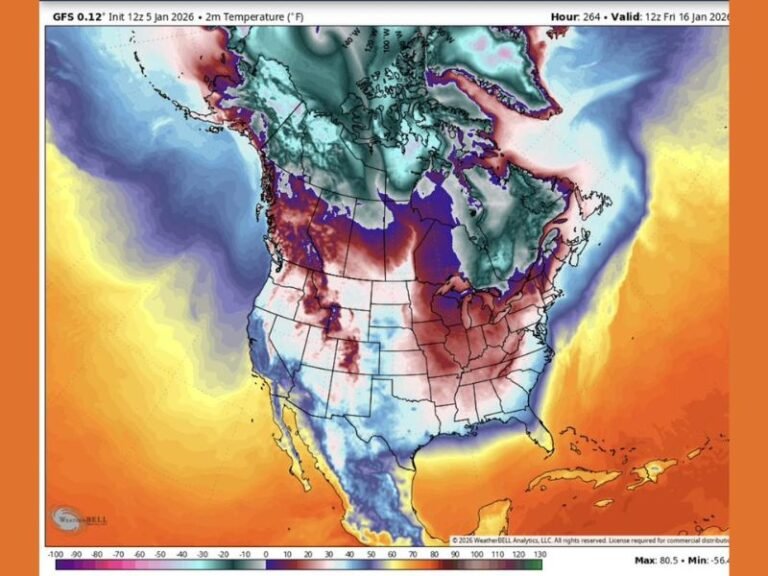
UNITED STATES — A significant Arctic blast is shaping up for the upcoming weekend, marking a major pattern change for much of the country as the coldest temperatures of the season surge southward. While it is still too early to make definitive calls on precipitation type or impacts, confidence is growing that very cold air and moisture will overlap, creating the potential for wintry weather across a large portion of the South and Eastern U.S.
Forecasters stress that even small temperature differences of one or two degrees could dramatically change outcomes, making this a complex and closely watched setup.
Why This Arctic Blast Is a Big Deal
This event is driven by a deep push of Arctic air combined with increasing moisture moving in from the south. The result is a volatile winter pattern where snow, sleet, freezing rain, or cold rain are all possible depending on how the atmosphere stacks up vertically.
Meteorologists note that forecasting challenges are elevated because it’s not just surface temperatures that matter, but temperature changes with height in the atmosphere, which ultimately determine what type of precipitation reaches the ground.
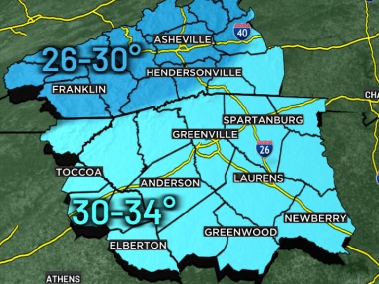
Coldest Temperatures and Wind Chills of the Season
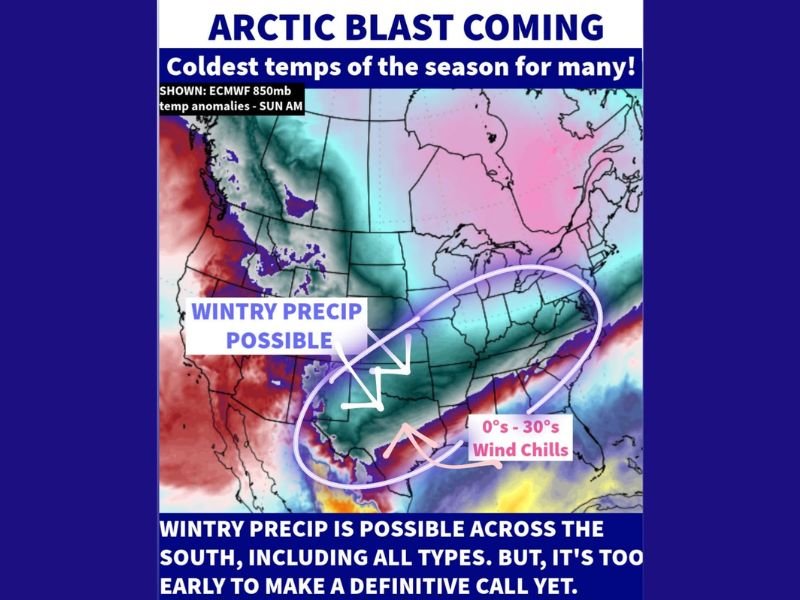
Current guidance suggests widespread temperatures well below normal, with wind chills ranging from the single digits into the teens and 20s, and potentially near or below zero in some areas farther north.
These conditions could pose health risks, especially for those exposed to the cold for extended periods, and increase the likelihood of frozen pipes, power strain, and travel disruptions.
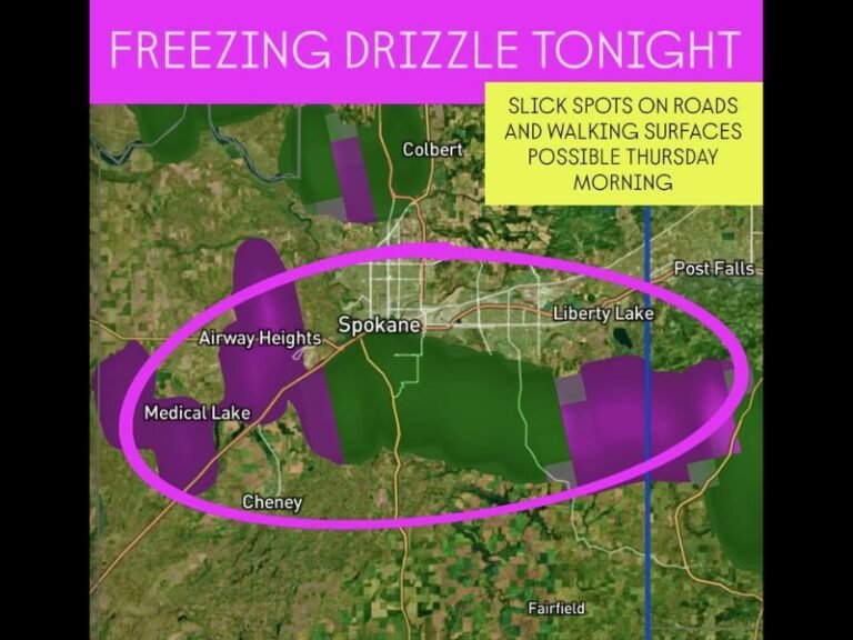
Wintry Precipitation Possible Across the South
The zone of concern stretches across Texas, the Gulf Coast states, the Tennessee Valley, and into parts of the Southeast and Mid-Atlantic. Forecast models indicate that wintry precipitation is possible across the South, including all precipitation types, though exact locations and amounts remain uncertain.
This type of setup is especially risky in southern states, where ice accumulation can cause power outages, dangerous road conditions, and tree damage.
Why Confidence Is Still Limited
Despite increasing consistency in the overall pattern, forecasters caution that it is still too early to lock in details. The entire vertical temperature profile remains uncertain, and subtle shifts could drastically change the forecast.
Residents are urged not to focus on exact snow or ice totals yet, but instead to prepare for dangerous cold and the possibility of disruptive winter weather.
What Residents Should Do Now
With more details expected in the coming days, now is the time to review winter safety plans, ensure heating systems are ready, protect pipes, and stay informed through reliable weather sources rather than sensational online posts.
This Arctic blast has the potential to be one of the most impactful cold events of the season, and preparedness will be key as winter shows it’s far from over.
Are you already feeling the shift toward colder weather where you live? Share your thoughts and stay updated with continued coverage at SaludaStandard-Sentinel.com.