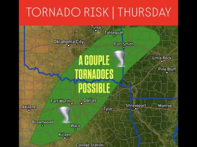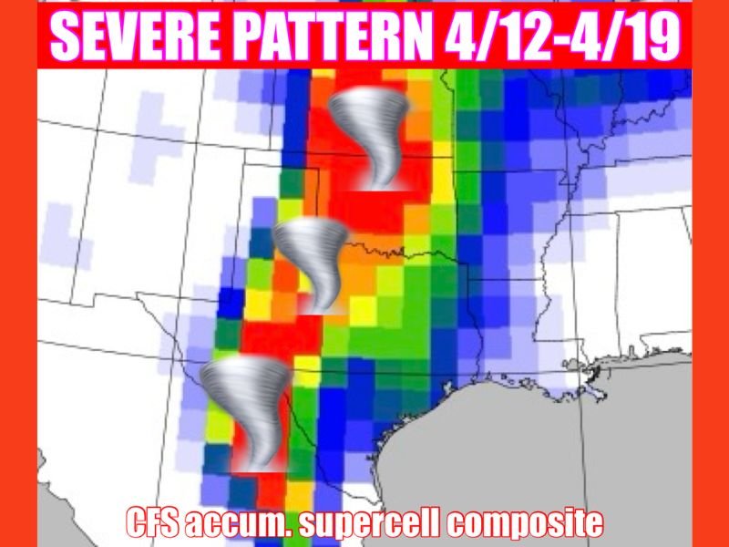
April 12 to April 19 Severe Weather Pattern Could Ignite Multiple Rounds of Storms Across Oklahoma, Texas and Central Plains With Tornado and Large Hail Risk
UNITED STATES — A developing mid-April weather pattern is raising concern across the Plains, with signals pointing toward a more active stretch of severe storms between April 12 and April 19.
Early indicators suggest this setup could support multiple rounds of storms across states like Oklahoma and Texas, bringing threats that include large hail, damaging winds, and potentially tornadoes.
Storm Pattern Signals Increasing Activity Across the Plains
Forecast trends show a noticeable shift toward a more favorable environment for severe weather across the central United States. This type of setup is commonly associated with active springtime outbreaks.
The pattern appears capable of producing repeated storm development rather than a single isolated event. That increases the likelihood of multiple storm days within the same weeklong window. While exact timing and locations remain uncertain, the overall signal is strong enough to warrant close attention across the region.
Supercells Could Bring Tornado, Hail and Wind Threats
This developing pattern may support supercell thunderstorms, which are known for producing some of the most intense severe weather.
These storms are capable of generating large hail, strong damaging wind gusts, and tornadoes under the right conditions. The presence of repeated storm cycles increases the chance for overlapping risks.
Areas across Oklahoma, north Texas, and surrounding Plains states could find themselves in the path of these stronger storm systems as the pattern evolves.
Multiple Rounds of Storms Increase Overall Risk
One of the key concerns with this setup is not just storm intensity, but frequency. Multiple rounds of storms can lead to compounded impacts over several days.
Repeated severe weather can strain infrastructure, increase the likelihood of damage, and heighten the risk of flash flooding in some areas. Even if individual storm events vary in intensity, the cumulative effect of several days of storms can create significant disruptions.
Too Early for Exact Timing but Pattern Worth Watching Closely
At this stage, it is still too early to pinpoint exact days, cities, or specific severe weather outbreaks. However, the broader pattern aligns with setups that have historically produced active severe weather periods.
As models continue to refine the forecast, more detailed outlooks will become available. For now, the focus remains on monitoring how this pattern develops heading deeper into April.
Now Is the Time to Prepare for Severe Weather Season
With a potentially active period approaching, now is the time for residents across the Plains to review their severe weather preparedness plans. Having multiple ways to receive warnings, identifying safe shelter locations, and staying informed can make a critical difference when storms develop.
Preparation is especially important during multi-day severe weather patterns, where risks can evolve quickly from one day to the next. As this mid-April setup continues to take shape, are you preparing for severe weather in your area? Share your plans and thoughts with us at SaludaStandard-Sentinel.com.