Alabama, Georgia, Tennessee, and Carolinas Could See Early January Cold Snap as Forecast Models Hint at Southern Snow Potential
GEORGIA — As the new year approaches, early forecasts suggest that Alabama, Georgia, Tennessee, and the Carolinas could experience a powerful cold snap accompanied by possible snow showers, signaling that January 2026 may start off with a wintry punch across the South.
Meteorologists reviewing European Centre for Medium-Range Weather Forecasts (ECMWF) data report that arctic air could dive deep into the southern United States during the first half of January, producing temperatures 15–25 degrees below normal and a renewed risk of light to moderate snow in several southern states.
Long-Range Models Show Familiar Southern Winter Setup
Early January model runs indicate a familiar pattern forming — a deep jet stream trough extending across the central and eastern U.S., funneling cold air from Canada into the Deep South.
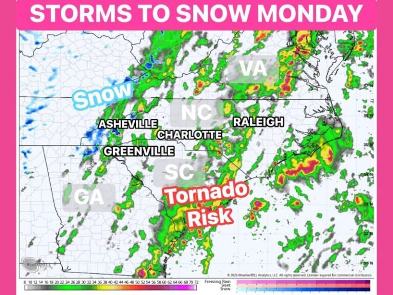
Forecasters believe this could bring periodic snow flurries or even localized accumulations from northern Alabama and Georgia into eastern Tennessee and the western Carolinas.
“It’s still too early to pinpoint exact totals, but the setup looks strikingly similar to last year’s early January cold wave,” said one forecast analyst reviewing ECMWF data.
Cold Fronts May Arrive in Quick Succession
Weather experts warn that this potential pattern could unleash multiple cold fronts within days of each other — a setup known for volatile temperature swings, gusty winds, and occasional snow bursts during overnight hours.
Residents across the South may once again experience that familiar winter rollercoaster — mild afternoons followed by freezing nights.
“January’s acting like it has unfinished business,” said a forecaster. “Same time frame, same attitude — the South’s not out of winter’s reach yet.”
What States Could See the Biggest Impact
If current projections hold, here’s what the region can expect:
- Alabama: Coldest air since last February with overnight lows near 20°F in the north.
- Georgia: Occasional snow flurries possible north of Atlanta; strong winds expected statewide.
- Tennessee: Potential for light snow bands and icy spots along the Cumberland Plateau and Smoky Mountains.
- North and South Carolina: Sharp drop in temperatures with possible mixed precipitation inland.
Strong northwest winds could also lead to dangerous wind chills and localized power outages in higher elevations.
Extended Model Trends Through February
According to ECMWF’s 32-day projection, valid through February 1, 2026, the pattern shows:
- Persistent below-average temperatures across the Midwest and Southeast,
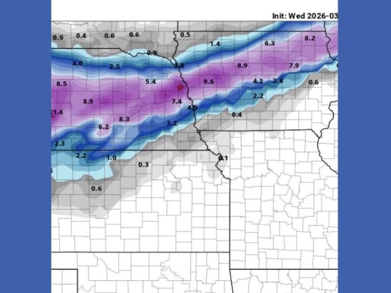
- Heavier snow accumulation potential from the Ohio Valley into the southern Appalachians,
- And a trend toward colder, stormier conditions lingering into late January.
Meteorologists caution that while snowfall predictions this far out remain uncertain, the setup strongly suggests that the South should stay winter-ready.
“Don’t put the coats away. Don’t trust the silence,” one forecaster warned. “January remembers — and it’s bringing the cold with it.”
How to Prepare
Residents are advised to:
- Monitor local forecasts for timing of cold fronts.
- Protect pipes, pets, and plants ahead of potential freezes.
- Check heating systems and vehicles before the first major cold push.
- Stay cautious on the roads if snow or ice develops.
As of now, the message is clear: the South’s mild December may be ending soon, and January looks ready to remind Alabama, Georgia, Tennessee, and the Carolinas that winter is far from over. Stay informed with real-time weather updates and safety alerts at SaludaStandard-Sentinel.com.