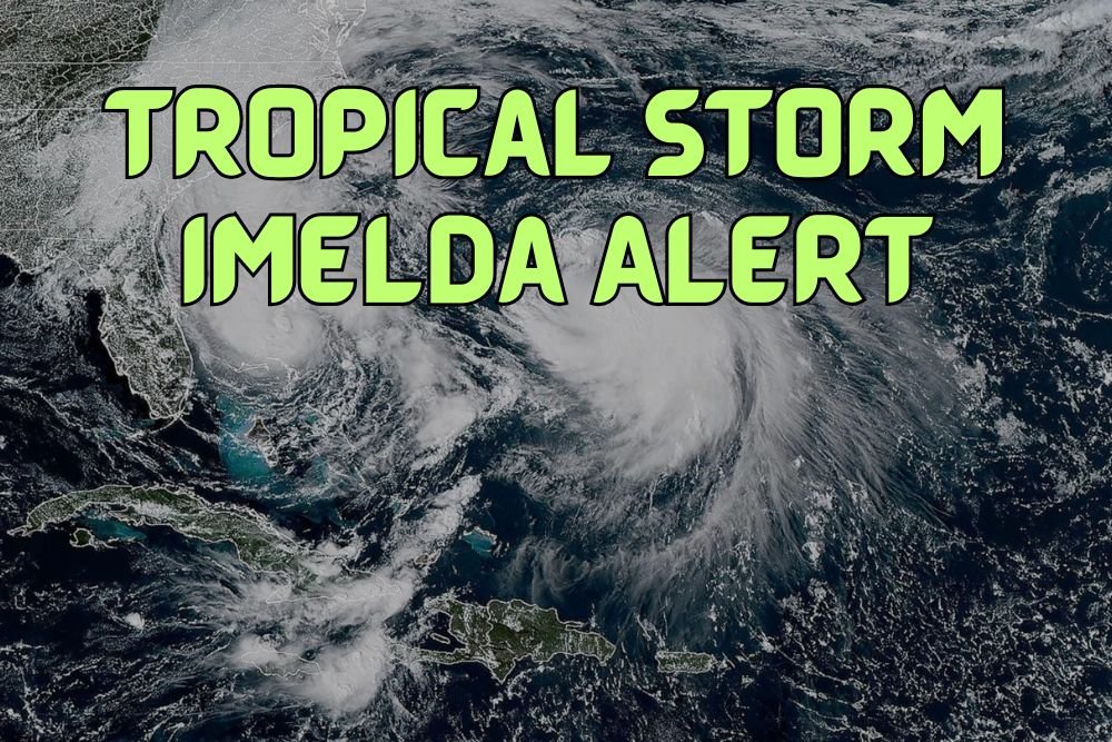
Tropical Storm Imelda Skirts Southeast Coast, Brings Dangerous Rip Currents and High Surf
WRIGHTSVILLE BEACH, N.C. — Tropical Storm Imelda is not expected to make landfall in the United States, but forecasters warn the system will skirt dangerously close to the Southeast coast, bringing rain, gusty winds, and days of high surf and rip currents.
Storm Track and Strength
As of Tuesday morning, Imelda is forecast to strengthen into a Category 1 hurricane, with further intensification possible as it moves northeast. By Wednesday evening, the storm could reach Category 2 strength near Bermuda before heading out to sea Thursday.
While the storm avoids a direct U.S. landfall, ABC News Chief Meteorologist Ginger Zee, reporting from Wrightsville Beach, said coastal areas should expect hazardous conditions from Florida through the Carolinas.
Coastal Impacts
- Florida: Gusts up to 40 mph along the central coast Monday; waves between 7–11 feet from Port St. Lucie northward.
- Carolinas & Virginia: Rainfall spreading north Monday and Tuesday, with 5–10 foot waves expected along the Outer Banks and Virginia Beach through Thursday.
- Rip Currents: Life-threatening rip currents forecast at beaches from Florida to North Carolina, continuing up to the Mid-Atlantic.
High surf advisories remain in effect across large portions of the coastline, with officials warning swimmers and boaters to stay out of the water.
Humberto Also in the Atlantic
Meanwhile, Hurricane Humberto has strengthened into a Category 4 storm, forecast to bring heavy rain to Bermuda Tuesday before veering northeast into the Atlantic.
Safety Reminders
Officials emphasize that even without landfall, tropical systems create dangerous beach and boating conditions. Residents are urged to heed local advisories, avoid swimming, and secure waterfront property.
Have you seen rising surf or rip current impacts along beaches in your community this week? Share your updates in the comments on SaludaStandard-Sentinel.com.