Tropical Storm Chantal Weakens to Depression After Sweeping Across Carolinas
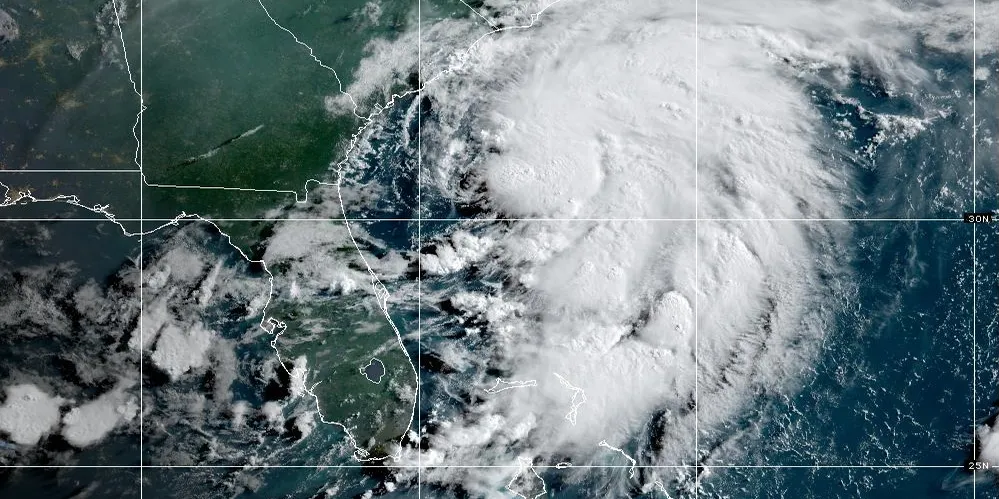
COLUMBIA, S.C. — Tropical Storm Chantal lost strength and was downgraded to a tropical depression Sunday, July 6, after making landfall near Litchfield Beach, South Carolina, in the early morning hours. Despite weakening, the storm still poses significant threats of flooding, dangerous surf, and rip currents across the region.
Landfall and Immediate Impacts
According to the National Hurricane Center, Chantal made landfall around 4 a.m. with sustained winds near 35 mph and higher gusts. By midmorning, it had slowed to a depression while tracking north at about 9 mph toward eastern North Carolina.
Forecasters warned the system could still drop 2 to 4 inches of rain, with isolated areas seeing up to 6 inches. Coastal flooding from storm surge and high tides was expected in low-lying areas.
The NHC also cautioned that life-threatening surf and rip currents will likely persist from Florida’s coastline up through the Carolinas well into next week.
Broader Coastal Risks
The effects of Chantal extend far beyond its center. AccuWeather meteorologists reported that rough surf and hazardous rip currents could impact communities from Savannah, Georgia, to Jacksonville, Florida. While the storm’s strongest winds remained offshore, areas east of the landfall zone were at risk for tree damage, power outages, and localized structural damage.
Seasonal Context
Chantal is the third named storm of the 2025 Atlantic hurricane season, which began June 1 and runs through November 30. It followed Tropical Storms Andrea and Barry in June, marking an active start to the season. Historically, peak hurricane activity occurs from mid-August to mid-October.
How Tropical Storms Form
Hurricanes and tropical storms develop over warm tropical waters—typically above 80°F. Clusters of thunderstorms can evolve into tropical depressions and, if winds reach 39 mph, into named tropical storms. Sustained winds of 74 mph or greater classify the system as a hurricane.
Safety Precautions Urged
While Chantal continues to weaken, emergency officials urge residents to remain vigilant. The NOAA recommends:
- Prepare disaster supplies — food, water, medicine, and other essentials for storm impact and recovery.
- Check insurance coverage — especially flood insurance, which requires a 30-day waiting period.
- Plan evacuation routes — and identify a safe meeting location outside your community.
- Fortify your home — trim trees, seal wall openings, and install storm protection.
As the storm moves further inland, residents in its path are advised to monitor updates from the National Hurricane Center and local authorities.
Have you experienced flooding or damage from Chantal? Share your story with the Saluda Standard-Sentinel to help keep our community informed and prepared.