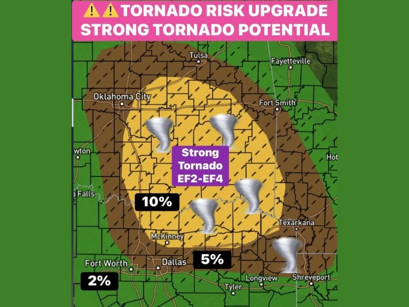
EF-2 to EF-4 Tornado Risk Upgrade Across Oklahoma and East Texas Tonight — Supercells Bringing 70 to 80 MPH Winds and Significant Hail Sliding Southeast
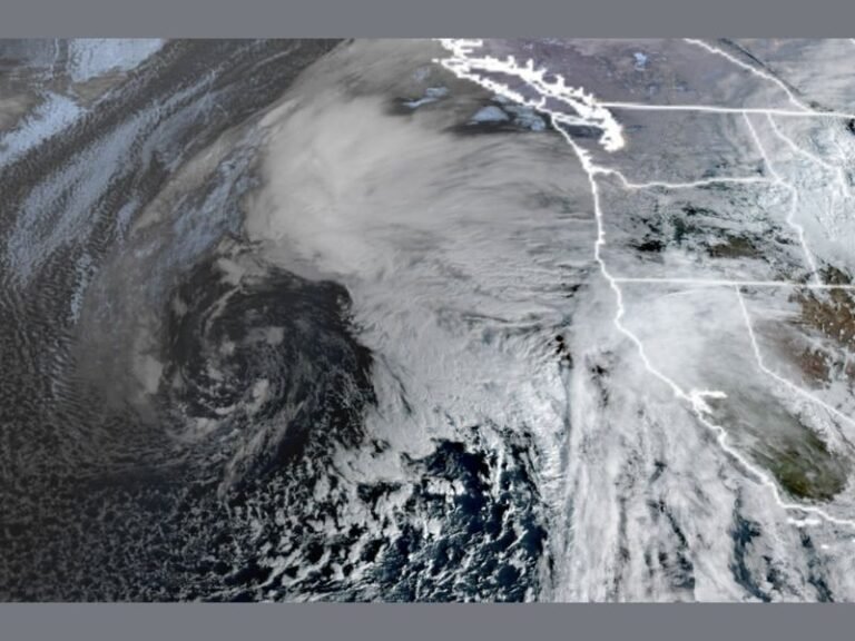
OKLAHOMA CITY, OKLAHOMA — A tornado risk upgrade was issued for Oklahoma late afternoon into the evening, with the atmosphere primed for strong tornado potential reaching EF-2 to EF-4 strength. The 10 percent tornado probability zone covered a significant corridor centered over central Oklahoma, with supercells expected to slide southeast tonight into East Texas bringing significant hail and intense damaging winds of 70 to 80 mph alongside the tornado threat. Forecasters described the day and night ahead as dangerous for both Oklahoma and East Texas.
EF-2 to EF-4 Tornado Potential Upgraded Across Central Oklahoma Late Afternoon Into Evening
The tornado risk upgrade placed the highest concern zone over central Oklahoma, with the yellow 10 percent tornado probability area covering the corridor from just south of Oklahoma City southeastward through the region toward the Texas border. Within the 10 percent zone, strong tornado potential reaching EF-2 to EF-4 intensity was explicitly identified, placing this event in the category of a significant and potentially violent tornado outbreak for the affected area.
The atmosphere was described as prime for strong tornado development, with all ingredients in place for supercells to produce long-track, high-end tornadoes during the late afternoon and evening hours across the Oklahoma risk zone.
Supercells Sliding Southeast Into East Texas Tonight — Significant Hail and 70 to 80 MPH Winds
The supercells generating the tornado threat in Oklahoma were expected to slide southeast overnight into East Texas, carrying the tornado danger and associated hazards into that region as the evening progressed. Alongside the tornado threat, significant hail and intense damaging winds reaching 70 to 80 mph were forecast to accompany the supercells as they tracked from central Oklahoma southeastward through the region toward Texarkana, Longview, and Shreveport.
The combination of violent tornado potential, significant hail, and near-hurricane-force damaging winds made this a multi-hazard event requiring serious preparation across both Oklahoma and East Texas heading into the evening.
Tornado Probability Breakdown — 10 Percent Core, 5 Percent and 2 Percent Extending Outward
The tornado probability map showed a clear gradient of risk across the region. The yellow core carried a 10 percent chance of a tornado within 25 miles of any given point, covering central Oklahoma as the highest risk zone. The surrounding brown zone carried a 5 percent probability extending through the Dallas and Fort Worth corridor, while the outer green zone carried a 2 percent probability reaching toward Fort Worth and further south.
Residents across all zones were urged to stay weather aware through the dangerous night ahead. Stay with saludastandard-sentinel.com for the latest weather updates and detailed forecast coverage.