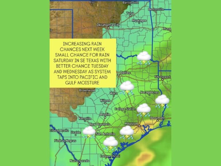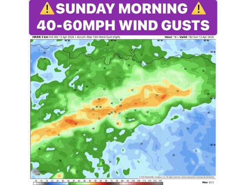
Texas Faces 40 to 60 MPH Wind Gusts, Torrential Rain and Flash Flood Warnings as Dangerous Sunday Morning Storm Line Strikes North and South Texas April 12
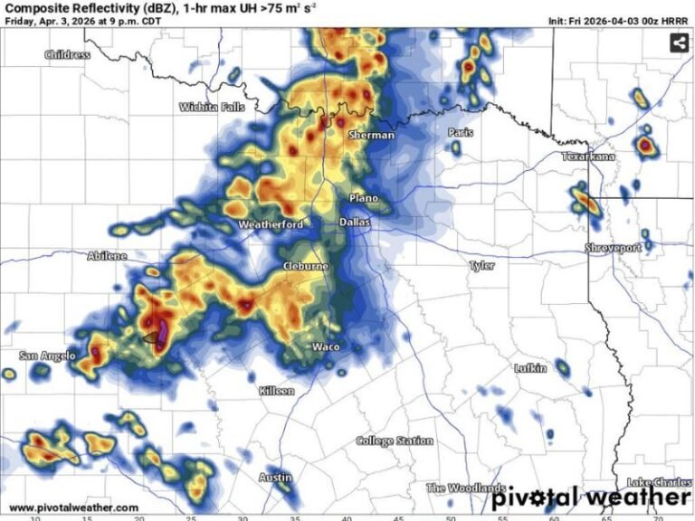
TEXAS — A dangerous line of storms is building across Texas this Sunday morning, April 12, 2026, bringing 40 to 60 MPH wind gusts, lightning, torrential downpours, and a serious flash flooding threat to communities across both North and South Texas. Flood warnings have already been issued across West Texas as the storm line pushes eastward and is set to arrive in North Texas before sunrise, with the greatest flood risk developing south of Interstate 20 extending down through Austin and San Antonio.
Strong Wind Gusts and Heavy Rain Moving Into North Texas Before Sunrise
The approaching storm line is expected to reach North Texas before sunrise Sunday morning, bringing with it some of the most dangerous conditions of the event. Wind gusts of 40 to 60 MPH are forecast with the strongest storm cells, capable of downing tree limbs, scattering debris, and creating hazardous driving conditions across the region.
Lightning will be frequent and intense throughout the storm line, and pockets of very heavy rain will accompany the strongest cells as they push through. Residents across North Texas are urged to secure any loose outdoor items before the storms arrive and to avoid unnecessary travel during the pre-dawn hours.
Water Content Values Supporting Torrential Downpours
Atmospheric water content values at 1.8 inches are fueling the potential for extremely heavy rainfall within the strongest storm cells. At these moisture levels, torrential downpours capable of dropping significant rainfall in a very short period are expected, rapidly overwhelming drainage systems and creating dangerous standing water on roadways across the affected corridor.
Drivers are strongly urged to follow the turn around, don’t drown principle and avoid any roadway covered by water regardless of how shallow it appears. Even a small amount of fast-moving floodwater is capable of sweeping vehicles off roads.
Greatest Flash Flood Risk South of I-20 Down to Austin and San Antonio
The most serious flash flooding threat is focused south of Interstate 20, where a solid batch of heavy rainfall is expected to develop and push down through the Austin and San Antonio areas. Flood warnings are expected to be issued across this corridor as rainfall totals accumulate rapidly across already saturated or drought-stressed soils that cannot absorb water quickly enough.
Residents in low-lying neighborhoods, near creeks, or in flood-prone areas between the Dallas metro and San Antonio should monitor local emergency alerts closely throughout the morning hours and be prepared to move to higher ground if flooding develops near their location.
Are you tracking the Sunday morning storm threat in your area? Stay safe and share your reports at SaludaStandard-Sentinel.com.