Illinois Tornado Count Reaches 53 Already in 2026 With Chicago, Kankakee, Springfield and Central Counties Near Annual Average Before Peak Season
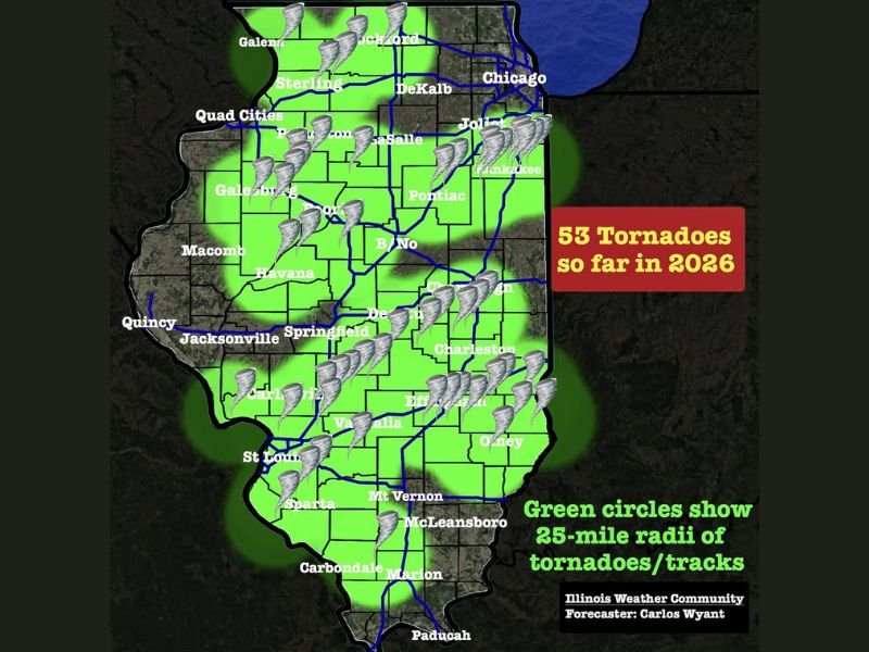
ILLINOIS — Tornado activity across the state has surged to alarming levels early in 2026, with 53 confirmed tornadoes already recorded — just one shy of the annual average of 54.
What makes this milestone even more concerning is timing. Illinois typically sees its peak tornado season between April and June, meaning the state has nearly reached a full year’s average before the most active months have even begun.
Tornado Activity Already Spans Much of the State
Data shows tornado touchdowns have been widespread across Illinois, impacting regions from northern areas near Chicago to central and southern counties including Springfield, Charleston, and Carbondale.
Mapping of the tornado tracks reveals that large portions of the state fall within a 25-mile radius of at least one tornado this year. For many residents, this means tornado activity has occurred either directly in their community or nearby. This widespread coverage highlights just how active the pattern has been across Illinois in recent months.
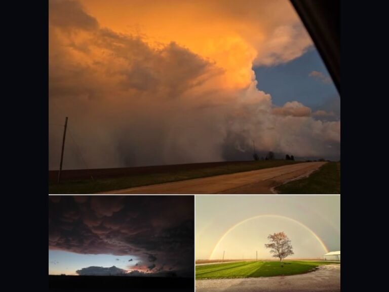
Kankakee Area Saw One of the Strongest Tornadoes
Among the most significant events this year was a powerful EF-3 tornado that tracked from Kankakee to Roselawn. This storm produced winds estimated at 160 miles per hour and carved a path stretching over 35 miles.
The tornado resulted in three fatalities, making it one of the most impactful severe weather events in the state so far this year. Kankakee County alone has recorded seven tornado touchdowns, with five additional events reported in Montgomery County, further emphasizing how concentrated activity has been in certain areas.
State Already Near Annual Average Before Peak Season
The fact that Illinois has reached 53 tornadoes before entering its most active period is raising concern among weather observers and residents alike.
April through June typically brings the highest frequency of severe weather across the Midwest. Entering this window with numbers already near the yearly average suggests the potential for an above-average tornado year. If the current pattern continues, additional tornadoes are likely to push totals well beyond normal levels.
Persistent Severe Weather Pattern Driving Activity
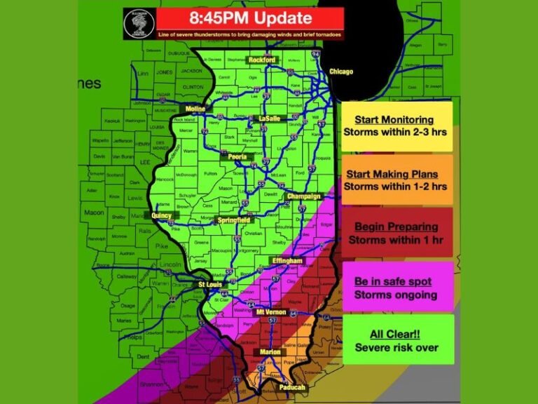
The ongoing surge in tornado activity is tied to a persistent and active weather pattern that has produced repeated storm systems across the region.
Frequent atmospheric disturbances, combined with favorable temperature and moisture conditions, have created an environment supportive of tornado development. This non-stop pattern has led to consistent severe weather threats, with little downtime between systems.
April Outlook Suggests Continued Active Conditions
Looking ahead, early indications suggest that April may continue the trend of elevated tornado activity across Illinois.
With peak season now beginning, the potential for additional severe weather events remains high. While specific forecasts will evolve, the overall pattern points toward continued storm development opportunities. Residents across the state are encouraged to remain alert as conditions continue to change.
Residents Urged to Stay Prepared as Season Intensifies
With tornado season just beginning and activity already near annual averages, preparedness will be critical in the weeks ahead.
Having a safety plan, monitoring weather updates, and understanding local warning systems can make a significant difference during severe weather events.
The early surge in tornado activity serves as a reminder that the season is already underway — and could intensify further. Have you experienced tornado activity in your area this year? Share your story with us at SaludaStandard-Sentinel.com and help others stay informed.