Michigan Weather Alert Targets Detroit, Ann Arbor and Pontiac Areas as Snow Dusting and 30 MPH Wind Gusts Reduce Visibility Tonight
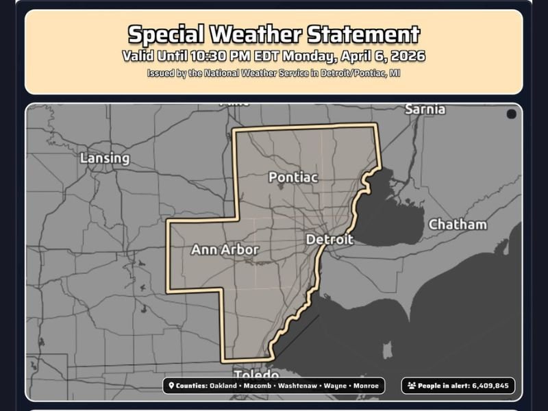
MICHIGAN — A special weather statement has been issued for parts of southeast Michigan, including Detroit, Ann Arbor, Pontiac, and surrounding counties, as a burst of snow and gusty winds is expected to impact visibility through the late evening hours.
The alert remains in effect until 10:30 PM EDT Monday, covering Oakland, Macomb, Washtenaw, Wayne, and Monroe counties.
Snow Dusting and Wind Gusts Creating Visibility Concerns
The primary concern with this weather setup is a light but impactful dusting of snow combined with wind gusts reaching up to 30 miles per hour. While snowfall amounts are expected to remain minimal, the blowing snow could significantly reduce visibility on roadways.
Drivers across the region may encounter sudden drops in visibility, especially in open areas where wind can easily lift loose snow and create brief whiteout-like conditions. These types of conditions can develop quickly, making travel more hazardous even without heavy snowfall accumulation.
Southeast Michigan Counties Under Alert
The impacted region includes several densely populated counties across southeast Michigan, stretching from Ann Arbor through Detroit and north toward Pontiac.
This area includes major roadways and travel corridors, increasing the potential for disruptions during the evening commute and nighttime travel hours. With over six million people within the alert zone, even minor weather impacts could affect a large number of residents.
Travel Impacts Likely Despite Light Snowfall
Although this is not a major winter storm, the combination of light snow and gusty winds can still create dangerous travel conditions. Reduced visibility remains the biggest risk, particularly for drivers traveling at higher speeds.
Road surfaces may also become slick in spots where snow briefly accumulates, especially on bridges and elevated surfaces. Motorists are advised to slow down, use headlights, and remain alert for rapidly changing conditions.
Conditions Expected to Improve Later Tonight
The weather system responsible for this alert is expected to move through relatively quickly, with conditions gradually improving after the late evening hours.
As winds begin to ease and snowfall tapers off, visibility should improve, reducing travel hazards overnight. However, until that improvement occurs, drivers should exercise caution across the affected counties.
Stay Alert for Changing Conditions
Even short-lived weather events like this can have a noticeable impact, particularly in heavily traveled regions. Staying informed and adjusting travel plans if necessary can help reduce risks.
Residents are encouraged to monitor updates and be prepared for brief periods of reduced visibility this evening. Are you seeing snow or reduced visibility in your area tonight? Share your conditions with us at SaludaStandard-Sentinel.com and help keep others informed.