Illinois and Southern Wisconsin Forecast Turns Warmer With Repeated Rain Chances From Wednesday Night Through Monday
ILLINOIS AND WISCONSIN — A major shift in the weather pattern is expected across northern Illinois and southern Wisconsin, with warmer temperatures and repeated chances of rain developing from midweek through early next week.
After a brief stretch of dry conditions, the forecast indicates a more active pattern returning, though widespread washouts or severe weather are not expected at this time.
Dry Start Tuesday Before Pattern Shifts Overnight
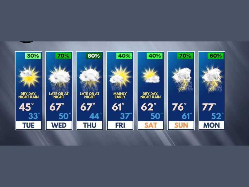
Tuesday will bring a temporary break in precipitation, offering a mostly dry day across the region. However, conditions are expected to change quickly by Tuesday night as a fast-moving system introduces renewed chances for rain.
There is also a slight possibility that colder air early in the transition could allow for a brief mix of sleet or even wet snow, though any wintry precipitation is expected to be minimal and short-lived.
Rain Chances Build Midweek With Multiple Rounds Expected
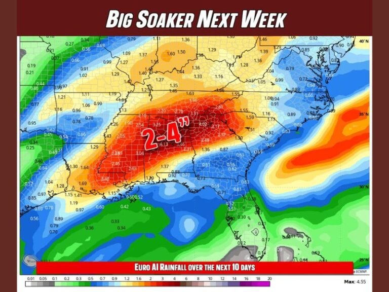
Beginning Wednesday night, rain chances increase significantly, marking the start of a more active stretch. Forecast data shows the most consistent precipitation opportunities arriving late Wednesday into Thursday, with additional chances continuing into Friday.
Rather than steady rainfall, this pattern will bring intermittent showers, meaning there will be periods of dry weather between rounds of rain. This stop-and-go pattern reduces the likelihood of flooding but keeps conditions unsettled through the latter half of the week.
No Major Severe Weather Threat Expected
Despite the increase in precipitation, severe weather is not expected to be a concern for several days. Current indicators show limited instability and no significant signals for strong storms in the short term.
While conditions later in the weekend or early next week will continue to be monitored, there are no immediate signs of severe weather outbreaks. This provides some relief as the region transitions into a wetter pattern without added severe risks.
Weekend Turns Warmer With Springlike Temperatures
Temperatures are expected to trend upward after Tuesday, bringing a more noticeable spring feel across the region. Highs will climb into the 60s by midweek and could reach the mid to upper 70s by Sunday and Monday.
In some areas, temperatures near 80 degrees are possible if rainfall remains limited during the warmest parts of the day. This warming trend will coincide with continued rain chances, particularly later in the weekend.
Best Rain Timing Highlights Late Week and Weekend
The most favorable windows for rain currently appear to be Wednesday night, late Thursday into Thursday night, early Friday, and again Saturday night.
Additional scattered chances could develop Sunday and Monday, though these remain more uncertain and hit-or-miss in nature. Overall, the pattern supports occasional rainfall rather than continuous precipitation, allowing for extended dry periods between systems.
A More Active but Manageable Spring Pattern Ahead
The developing pattern signals a transition toward a wetter and warmer regime typical of mid-spring across Illinois and Wisconsin. While rain will be more frequent, the lack of severe weather and absence of prolonged heavy rainfall events suggests manageable conditions overall.
Residents should stay aware of changing daily conditions but can expect a mix of dry periods, mild temperatures, and passing showers in the days ahead. How are you preparing for this shifting spring weather pattern? Share your thoughts and local conditions with us at SaludaStandard-Sentinel.com.