Cold Front Weakens Across Southeast but Northwest Georgia Still Faces Isolated Strong Storm Risk as System Pushes East
UNITED STATES — A cold front sweeping across the Southeast is continuing to weaken, but forecasters say a limited threat for isolated strong storms remains, particularly across parts of northwest Georgia.
The system, which earlier showed broader severe weather potential, is now losing strength as it moves eastward, reducing the overall risk across much of the region.
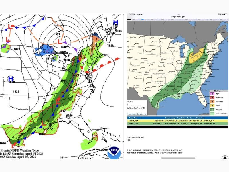
Cold Front Loses Strength as It Moves East
Weather maps show the front stretching from the Gulf Coast through the Southeast and into the Mid-Atlantic. However, the system is no longer as organized or intense as it was earlier in its development.
As it progresses eastward, the atmosphere ahead of the front appears less supportive of widespread severe weather, contributing to the weakening trend.
Northwest Georgia Remains a Focus for Isolated Storms
Despite the overall decline in strength, northwest Georgia remains an area to watch. A slight risk for stronger storms persists, meaning a few storms could still produce gusty winds or brief heavy rainfall.
Cities and communities in this region may experience passing storms as the front moves through, especially during peak heating hours when instability is slightly higher.
Broader Southeast Sees Reduced Severe Weather Threat
Across much of the Southeast, including Alabama, Mississippi, and parts of Tennessee, the severe weather risk has diminished significantly. Rain and thunderstorms may still occur, but the likelihood of damaging conditions is much lower.
This shift is a result of weaker atmospheric dynamics and reduced instability, which are key ingredients for stronger storms.
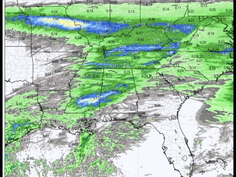
Rain and Storms Continue Along Frontal Boundary
Even as the severe threat decreases, a band of rain and thunderstorms continues along the cold front. This line of precipitation is expected to move steadily east, bringing periods of rain to areas across the Southeast and into parts of the East Coast. Some localized heavier downpours are still possible, particularly along the leading edge of the front.
System Expected to Continue Weakening Into Eastern States
As the front moves further east, it is expected to continue weakening, with only scattered showers and isolated storms remaining by the time it reaches the eastern seaboard. The most significant impacts are likely to remain limited and localized rather than widespread.
Residents Encouraged to Stay Aware Despite Lower Risk
Even with a reduced threat, residents in northwest Georgia and surrounding areas are advised to stay weather aware in case stronger storms briefly develop.
Monitoring local conditions and updates will help ensure safety as the system passes through. If you’re seeing storms move through your area, share your updates with us at SaludaStandard-Sentinel.com and help others stay informed.