Alabama Weather Whiplash Brings Tornadoes, Severe Storms and Possible Snow as March Cold Blast Targets the State
ALABAMA — Residents across the state are bracing for a dramatic weather reversal as a stretch of unusually warm March temperatures gives way to severe storms, powerful winds, and even the possibility of light snow early next week.
Meteorologists say the first part of March brought springlike warmth across Alabama, but the pattern is now shifting sharply. After several days of severe weather, a strong cold blast is expected to sweep through the region, dropping temperatures rapidly and bringing winterlike conditions back to parts of the state.
Unseasonably Warm Start to March Across Alabama
The first half of the month began with temperatures far above normal across Alabama. Weather data shows the first 11 days of March averaged roughly 15 degrees above seasonal averages, creating an unusually warm start to the month.
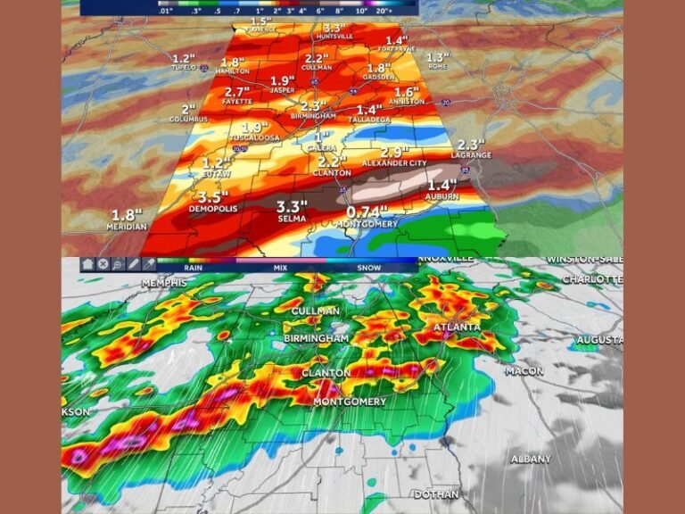
These warmer conditions helped fuel a volatile atmosphere capable of supporting powerful thunderstorms across the Southeast. The combination of warmth, moisture, and instability has already produced significant severe weather across the state during the past week.
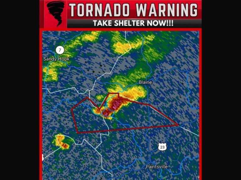
Multiple Tornadoes Confirmed Across the State
Storm reports indicate at least eight tornadoes have been confirmed in Alabama since Monday, highlighting the intensity of the recent storm systems moving through the region. These storms brought damaging winds, heavy rainfall, and severe thunderstorms to multiple communities. Meteorologists say the active pattern is not finished yet. Another round of potentially dangerous weather is expected to develop as the next system moves into the state.
Strong Storms and Damaging Winds Possible Sunday Night
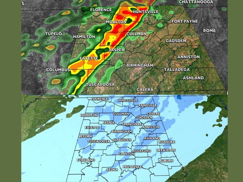
Forecast models show a new line of storms expected to develop Sunday evening and move across Alabama overnight into Monday morning. Weather projections suggest the strongest storms could impact areas including Florence, Moulton, Huntsville, Cullman, Jasper, and Fayette, with the potential for heavy rain, strong wind gusts, and severe thunderstorms.
Some storms could organize into a line capable of producing damaging winds as it pushes across northern portions of the state late Sunday night. Residents are being urged to stay weather aware as the system approaches.
Dramatic Temperature Drop Expected After Storms
Once the storms move through, a sharp surge of colder air is expected to sweep into Alabama. Meteorologists say this dramatic shift could bring wind chills into the 30s, representing a major drop from the unusually warm temperatures earlier in the month.
The rapid cooldown could also create conditions for a hard freeze in some areas by Monday night, potentially impacting sensitive plants and early spring vegetation.
Light Snow Possible Across Northern Alabama
In another surprising twist, parts of Alabama may even see light snow or flurries on Monday as the cold air settles in. Forecast projections show the highest chance for snowfall in northern portions of the state, including areas around Huntsville, Florence, Cullman, and Gadsden.
Snowfall totals are expected to remain light, with most areas likely seeing only minor accumulations or brief bursts that may whiten grassy surfaces. Forecasters emphasize that significant travel impacts are unlikely, but the possibility of seeing snow in mid-March remains unusual for the region.
A Wild March Pattern Still Developing
Meteorologists describe the upcoming weather pattern as one of the most dramatic shifts of the season, transitioning from springlike warmth to severe storms and then to near-winter conditions within just a few days.
Such rapid swings are not unheard of during March, but the combination of tornadoes, severe thunderstorms, strong winds, freezing temperatures, and possible snow within the same weather cycle highlights just how volatile early spring weather can be across the Southeast.
Residents across Alabama are encouraged to stay informed as the situation evolves and prepare for rapidly changing weather conditions through the weekend and into early next week. Readers experiencing severe weather or unusual conditions in their area can share their photos and reports with the community by visiting SaludaStandard-Sentinel.com.