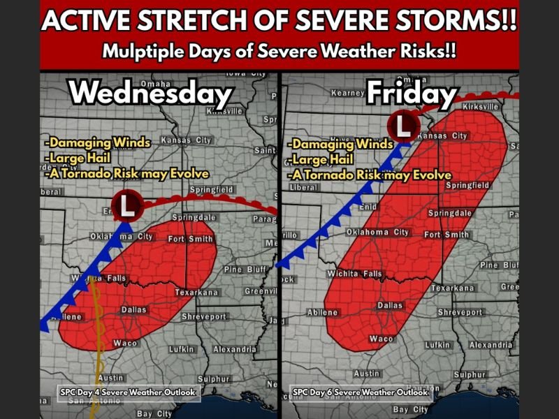
Southern Plains and Mid-South Face Two Designated Severe Weather Days Wednesday and Friday With Damaging Winds, Large Hail and Possible Tornado Risk
SOUTHERN PLAINS AND MID-SOUTH — Severe weather season is ramping up with two separate days already highlighted in advance by the Storm Prediction Center, signaling growing confidence that significant storms may develop across parts of Texas, Oklahoma, Arkansas and Missouri.
Forecast guidance points to both Wednesday and Friday as organized severe weather threats, with damaging winds, large hail and the potential for tornado development listed among the primary concerns.
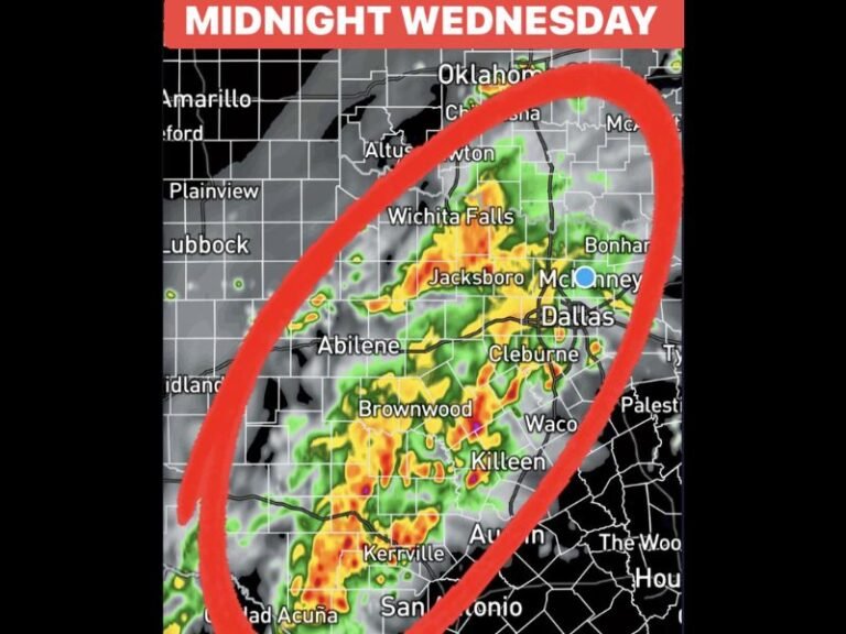
Wednesday: Storm System Targets North Texas and Southern Oklahoma
The midweek setup shows a developing low-pressure system and frontal boundary stretching across the Southern Plains. The outlined risk area includes cities such as Dallas, Waco, Abilene, Wichita Falls and extends northeast toward Fort Smith and surrounding portions of Arkansas.
Forecasters indicate:
- Damaging straight-line winds
- Large hail
- A tornado risk that may evolve depending on instability and wind shear
Storm development is expected along and ahead of the advancing front. While exact storm timing and intensity will become clearer closer to the event, confidence is increasing that at least scattered severe storms could form.
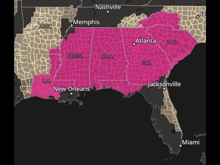
Friday: Broader Risk Expands Northeast
By Friday, model data suggests another strong system will track across the region, with a more elongated risk zone stretching from North Texas through central and eastern Oklahoma into Missouri and parts of the Mid-South.
Major cities within the projected risk corridor include Dallas, Oklahoma City, Springfield and areas near Kansas City.
Similar hazards are expected:
- Damaging winds
- Large hail
- A tornado risk that could increase depending on storm organization
The Friday setup appears more expansive geographically, covering a wider swath of the Southern Plains into the Mid-South.
More Active Days Possible
Meteorologists caution that this may not be limited to just two days. With a progressive spring pattern developing, additional severe weather days could be added as updated forecast data becomes available.
The combination of strengthening jet stream dynamics, increasing Gulf moisture and surface boundaries is creating an environment favorable for multiple rounds of thunderstorms.
Residents across Texas, Oklahoma, Arkansas and Missouri are encouraged to review severe weather safety plans and monitor official forecasts as the week unfolds.
Are you located in one of the highlighted areas? Share how you are preparing for severe weather season at SaludaStandard-Sentinel.com.