Southern Plains and Mississippi Valley Brace for High-Risk Heavy Rain and Severe Storm Threat as March Roars In
SOUTHERN PLAINS — March is poised to arrive with a powerful punch as forecast models signal a high risk of heavy precipitation across the Southern Plains and into the Mississippi River Valley, along with a growing threat of severe storms.
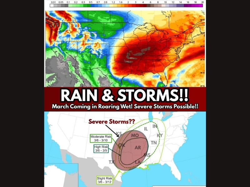
Meteorological guidance indicates several inches of rainfall could fall across Oklahoma, Arkansas, Missouri and surrounding states as a dynamic weather pattern sets up during the first full week of March.
Heavy Rainfall Targets the Mississippi River Valley
Long-range forecast models show a broad swath of intense precipitation stretching from parts of Texas and Oklahoma northeast through Arkansas and Missouri and into portions of the central Mississippi Valley.
Rainfall totals in some areas could reach multiple inches over several days, increasing the risk of localized flooding — especially in low-lying and already saturated regions.
The heaviest rainfall signals appear concentrated across:
- Eastern Oklahoma
- Western and central Arkansas
- Southern and central Missouri
- Northern Louisiana
- Portions of Mississippi
Forecasters say this system could evolve into a prolonged rain event rather than a quick-moving storm.
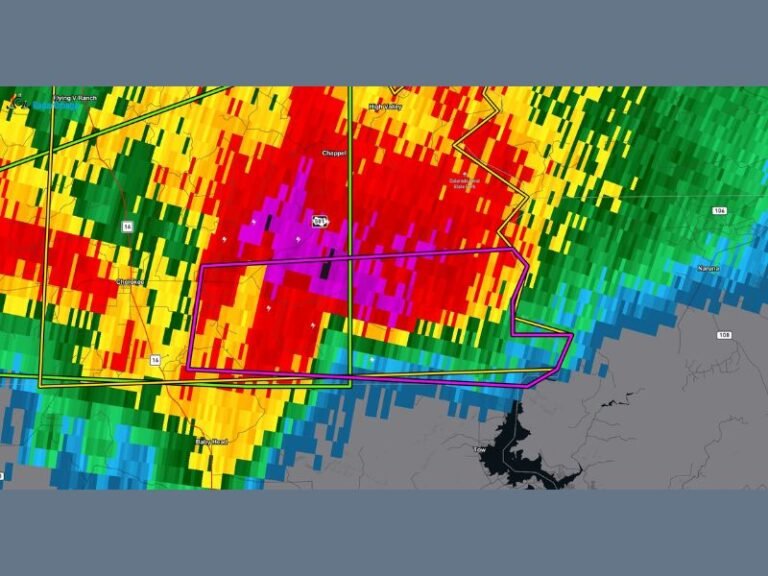
Severe Weather Risk Increasing
In addition to heavy rain, guidance suggests an uptick in severe weather potential during the same timeframe.
Forecast outlooks highlight a:
- Moderate Risk window between March 6 and March 10
- High Risk zone centered over parts of Oklahoma and Arkansas from March 6 to March 9
- Slight Risk extending farther south into Texas through March 12
The severe weather zone appears to stretch from eastern Texas through Oklahoma and Arkansas and into parts of Missouri, Tennessee, Kentucky and southern Illinois.
Meteorologists note that this setup aligns closely with the beginning of traditional severe weather and tornado season across the region.
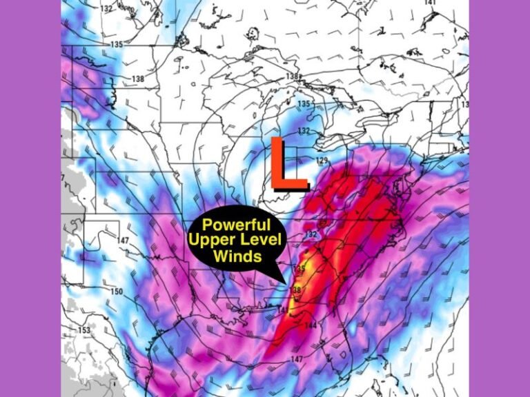
Why This Pattern Matters
The combination of deep moisture from the Gulf of Mexico and an advancing storm system from the west can create an environment favorable for:
- Strong to severe thunderstorms
- Large hail
- Damaging wind gusts
- Potential tornado development
When heavy rainfall overlaps with severe storm threats, emergency managers typically urge residents to stay alert for both flash flooding and rapidly changing weather conditions.
Monitoring the Developing Setup
While exact storm timing and intensity will become clearer in the coming days, forecasters are closely watching this system due to the breadth of impact across multiple states.
Residents across the Southern Plains and Mississippi River Valley are encouraged to monitor local forecasts and have severe weather plans ready as March begins on a turbulent note.
As spring approaches, this event may serve as an early signal that active storm patterns are returning for the season.
Are you in one of the highlighted risk areas? Let us know how you’re preparing and stay updated with ongoing weather coverage at SaludaStandard-Sentinel.com.