Northeast Snowstorm Threat Grows for New York and Long Island as Models Shift Closer to Major Weekend Impact
NEW YORK — A potential weekend snowstorm is back on the table for parts of the Northeast, including New York City and Long Island, as updated European model data shows a subtle but important shift closer to the coast. While the system is still considered an outlier by many models, confidence is slowly increasing that at least some areas could see accumulating snow by late Sunday into early Monday.
According to the latest early-morning model analysis, the primary European (Euro) run continues to show the storm mostly offshore. However, ensemble guidance — which looks at dozens of possible outcomes — has edged closer to a more impactful scenario.
20% of Euro Ensemble Members Show 8+ Inches for Long Island
One of the more notable developments is that 10 out of 50 Euro ensemble members (20%) now show at least 8 inches of snow for Long Island. That does not guarantee a major snowfall, but it signals that the threat cannot be dismissed.
Additionally, Euro-AI ensemble guidance has also trended slightly west, though the main operational run still keeps the system comfortably offshore. The overall takeaway: this is still a low-to-moderate probability event, but the risk window remains open.
Forecasters emphasize that Miller B Nor’easters — the type of system being discussed — are notoriously tricky. These storms often redevelop along the coast and can dramatically shift snowfall bands depending on small track adjustments.
Wind and Cold First, Then Storm Uncertainty
Before the storm threat materializes, residents across the Northeast will deal with windy and cold conditions today and tomorrow. Temperatures will run below normal tonight into Saturday morning, though not as brutally cold as previous outbreaks.
Wind gust forecasts show blustery conditions through Friday afternoon, with wind chills dipping into uncomfortable territory early Friday morning.
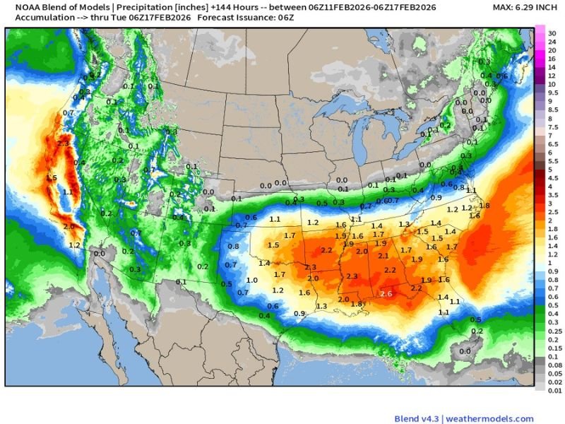
Model Blend Shows Offshore Heavy Precipitation Core
Precipitation blend guidance through Monday shows the heaviest precipitation remaining offshore in most simulations. However, the margin between a coastal graze and a more significant snowfall remains narrow.
Long Island temperature outlooks over the next 15 days suggest generally milder conditions next week, with mostly above-normal temperatures returning before another potential colder period later in the month.
What Happens Next?
At this stage, forecasters stress that nothing is locked in. The storm could:
- Miss entirely to the south
- Deliver a light graze with minor accumulations
- Or shift just enough west to produce a moderate snowfall event
With ensemble members trending slightly closer to the coast, this system remains one to monitor closely through the next 48 hours.
Residents in New York City, Long Island, and coastal New Jersey should stay updated as model guidance continues to evolve. Even small shifts of 50–100 miles in storm track could mean the difference between flurries and plowable snow. More updates are expected as new data comes in throughout the day.