Weekend Snow Threat Expands Westward as Stronger Coastal Low and Arctic Air Signal Higher Totals From the Carolinas Into the Southeast
UNITED STATES — Confidence is growing in a meaningful weekend snow event across parts of the Southeast and Carolinas as overnight forecast guidance continues to trend stronger, pushing higher-impact snowfall farther west and extending the duration of the system into Saturday.
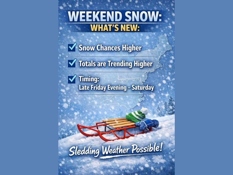
Meteorologists say this is no longer a marginal setup, with multiple models now showing a longer-lasting snow window and increased potential for accumulation in communities previously expected to see little or no snow.
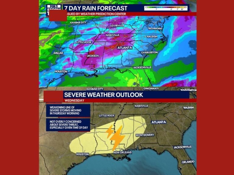
Snow Chances and Totals Continue Trending Higher
Overnight model runs show a clear shift toward higher snowfall potential, particularly west of earlier forecast lines. This trend increases the likelihood of accumulating snow across a broader portion of the region, with some areas potentially seeing snow suitable for sledding if rates and ratios verify.
Forecasters note that both deterministic models and ensemble guidance are aligning on this westward expansion, signaling improving confidence in the overall setup.
Timing Now Favors a Longer-Lasting Event
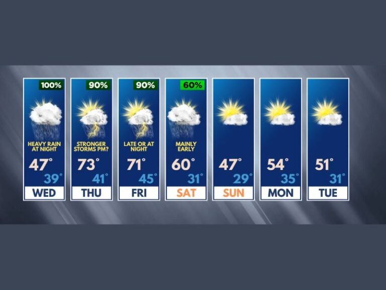
Snow is now expected to begin later Friday evening and continue through much of Saturday, rather than ending early as earlier forecasts suggested. This longer duration increases the risk of higher totals, especially where snow persists through the overnight hours when temperatures are coldest.
The extended timeline also raises concerns for travel impacts late Friday night into Saturday morning.
Why the Forecast Changed Overnight
The key change is a stronger piece of upper-level energy interacting more efficiently with a coastal low-pressure system. Forecast guidance now places that low closer to the coast before it is captured and pulled inland — a classic configuration for broader and longer-lasting snowfall.
The GFS, European, and ensemble datasets have all trended in this direction, adding confidence that the system will have greater inland reach.
Arctic Air Raises Snow Efficiency
This event is unfolding within a true Arctic air mass, not a marginal winter setup. As a result, snow-to-liquid ratios are expected to be much higher than normal, potentially closer to 15:1 instead of the typical 8:1 to 10:1.
That means lighter, fluffier snow capable of accumulating more efficiently, especially on frozen ground where little melting is expected.
Track of the Low Still Critical
Despite the improving signal, meteorologists caution that the exact track of the low-pressure system remains the biggest variable. A small east or west shift could still raise or lower snowfall totals locally, particularly along the western edge of the snow shield.
Additional model runs over the next 24 hours will be crucial in refining where the heaviest snow sets up.
What to Expect Going Forward
If current trends hold and snow ratios verify, some locations could exceed current snowfall projections. Forecasters emphasize that confidence is increasing, but final totals will depend on precise storm placement and intensity.
Residents across the Southeast and Carolinas are encouraged to stay alert for forecast updates as confidence continues to improve throughout the day.
Are you preparing for potential snow this weekend, or already seeing colder conditions set in? Share your local observations and stay informed with continued coverage from SaludaStandard-Sentinel.com.