Another Arctic Blast Signals Late-Week Cold Surge and Potential Winter Storm Track Across the Southern United States
UNITED STATES — Forecast guidance is increasingly pointing toward another significant surge of Arctic air arriving late next week, with ensemble models showing a strong and consistent signal for sharply colder temperatures spreading across a large portion of the Southern and Eastern United States. Meteorologists are also monitoring an active storm track developing alongside this cold push, raising concerns for additional snow and ice impacts in several regions.
The pattern suggests this will not be a brief cooldown, but a renewed winter setup capable of producing both well-below-normal temperatures and wintry precipitation, depending on exact storm placement.
Arctic Air Pushes Deep Into the South
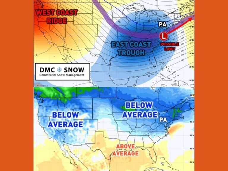
Temperature anomaly maps show deep purples and blues expanding southward, a clear indicator of Arctic-origin air spilling out of central Canada and pushing into the Plains, Lower Mississippi Valley, and Southeast. In some areas, temperatures could run 15 to 25 degrees colder than seasonal averages, especially during overnight and early morning hours.
This type of cold intrusion increases the likelihood of hard freezes across parts of Texas, the Gulf Coast states, and even sections of Florida if the cold air penetrates far enough south.
Storm Track Raises Snow and Ice Concerns
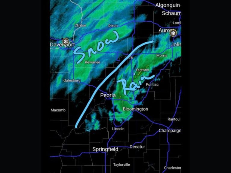
Along the southern edge of this Arctic air mass, models are hinting at a developing low-pressure system tracking from the southern Plains toward the Southeast or Mid-Atlantic. This setup is favorable for wintry precipitation, particularly where warm Gulf moisture overruns entrenched cold air at the surface.
Depending on timing and track, potential impacts include:
- Snow north of the freezing line
- Freezing rain or sleet across transition zones
- Cold rain farther south where surface temperatures remain above freezing
Small shifts in the storm’s path could significantly change who sees snow versus ice, making this a system to watch closely.
Timing: Late Next Week Into Next Weekend
Current ensemble guidance clusters around late next week, with the cold air arriving first, followed by storm development shortly thereafter. This sequence increases the risk for winter weather impacts rather than a simple cold rain event.
Forecasters caution that details will continue to evolve, and the exact impacts may change multiple times before confidence increases.
Why This Pattern Matters
This is not an isolated cold shot. The broader atmospheric pattern continues to favor repeated Arctic intrusions, keeping winter active well into the latter part of the season. Each new push of cold air raises the stakes for power demand, travel disruptions, and agricultural concerns, particularly in regions unaccustomed to prolonged cold. Residents across the Southern and Eastern U.S. are encouraged to stay alert as forecasts are refined over the coming days.
Stay with SaludaStandard-Sentinel.com for continued updates, refined timelines, and regional impact breakdowns as this developing winter pattern comes into sharper focus.