Major Southern Winter Storm Threatening Rare Snow, Crippling Ice, and Dangerous Cold Across South Carolina, North Carolina, Georgia, Alabama, Tennessee, and Mississippi
UNITED STATES — A high-impact winter storm is increasingly likely to unfold across large portions of the Southeast this weekend, with meteorologists warning of a rare combination of heavy snow, crippling ice, and extreme Arctic cold affecting South Carolina, North Carolina, Georgia, Alabama, Tennessee, and Mississippi, along with nearby states. Confidence is growing that significant impacts are locked in, even though exact placement of snow and ice corridors remains uncertain.
Why This Storm Is Considered High-Risk for the South
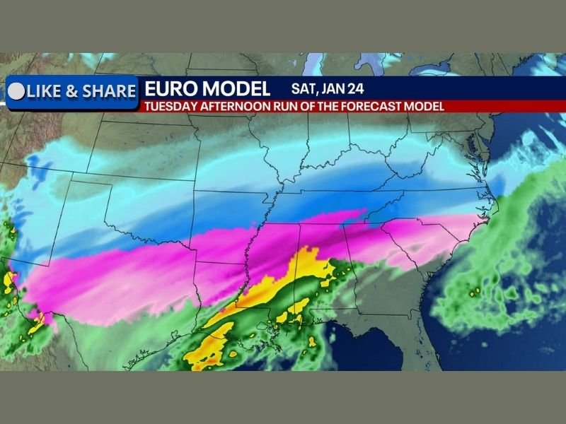
Forecast confidence is unusually high that this system will produce one of the most severe winter weather events the South has seen in many years. What makes this storm particularly dangerous is the razor-sharp north-to-south gradient expected in precipitation type.
In simple terms, a difference of 30 to 50 miles could mean the difference between a foot of snow and a crippling ice storm. Meteorologists emphasize that this is not speculation — both the EURO and GFS models are consistently showing extreme cutoff zones, where impacts change dramatically over short distances.
Heavy Snow Potential Where Cold Air Holds Firm
Where temperatures remain cold enough for all snow, forecasters say 12 inches or more of snowfall is very possible, even in areas that rarely experience major snowstorms.
This includes parts of:
- Northern Alabama
- Middle and eastern Tennessee
- Upstate South Carolina
- Western and central North Carolina
In these areas, snowfall rates could become intense enough to shut down travel quickly, especially Friday night through Sunday.
Crippling Ice Storm Risk Just South of the Snow Line
Just south of the heavy snow zone, the storm may transition into sleet and freezing rain, which poses a much greater threat to infrastructure.
Meteorologists stress that as little as 0.25 to 0.50 inches of ice can move a storm from disruptive to crippling. At those levels:
- Power lines can accumulate hundreds of pounds of extra weight
- Tree limbs and utility poles can snap
- Power outages may last days, not hours
- Roads become impassable, even for emergency vehicles
If freezing rain dominates, 1 inch or more of ice accumulation is possible in some locations, a level that historically leads to widespread, long-lasting outages.
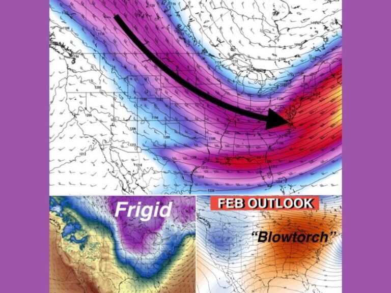
Extreme Cold Will Make Conditions Worse
Adding to the danger, Arctic air will surge south behind the storm, with the coldest conditions expected Friday morning through Saturday morning.
Forecast guidance shows:
- Air temperatures dropping into the single digits and teens
- Wind chills plunging into the -20s to -40s in some areas
This level of cold is life-threatening for anyone exposed for extended periods and poses a serious risk to pets, livestock, and vulnerable populations, especially during power outages.
Why Forecast Confidence Is High — Even With Uncertainty
Meteorologists are clear that this storm is happening. What remains uncertain is where the corridors of snow, sleet, and ice ultimately settle.
Recent EURO model runs have shifted the system northward by nearly 100 miles, highlighting how sensitive the setup is. Still, every major model agrees on the scale of the event, showing zones of:
- Heavy snow
- Significant sleet
- Crippling freezing rain
The uncertainty is not if impacts occur, but who gets which type of impact.
Travel Impacts Likely From Friday Night Through Sunday
Forecasters warn that travel could become extremely difficult or impossible at times across the region, especially overnight and during peak precipitation.
Even areas that see lower snowfall totals could experience flash icing, where rain freezes immediately on contact due to sub-freezing ground temperatures.
What Residents Should Do Now
Officials urge residents to prepare early, not panic. This includes:
- Reviewing travel plans for the weekend
- Stocking essentials in case of power outages
- Protecting pets, livestock, and pipes
- Staying updated as forecast details sharpen
Meteorologists caution that freezing rain is far more destructive than snow, and small forecast shifts can drastically change local outcomes.
This storm has the potential to be historic for parts of the South, not because of one single factor, but because of the dangerous overlap of snow, ice, and extreme cold.
Have you experienced a major winter storm in your area before, or are you preparing for one now? Share your thoughts and local conditions with us at SaludaStandard-Sentinel.com, and stay tuned for continued updates as this powerful system approaches.