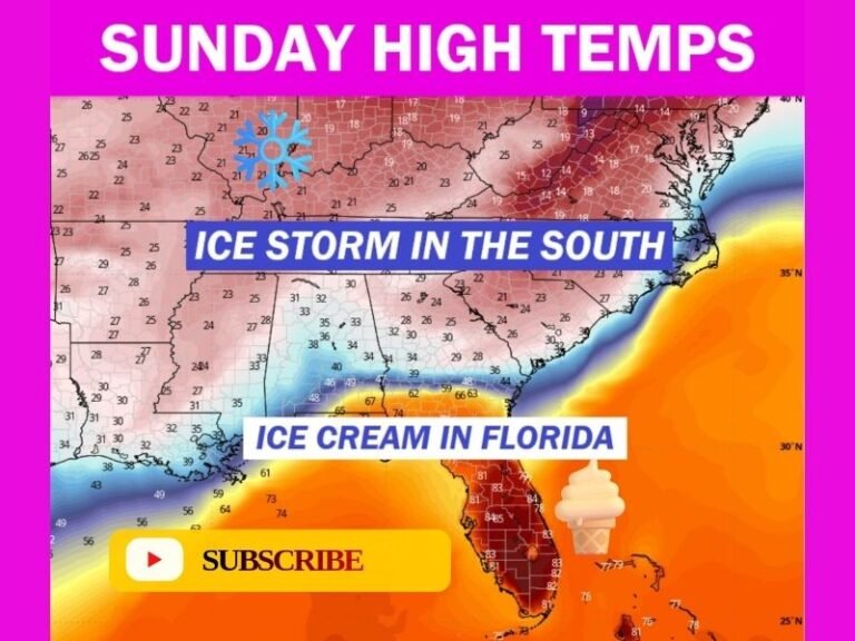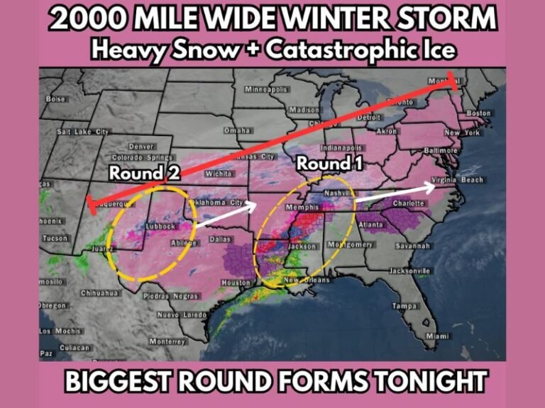
Texas Ice Storm Threat Intensifies as Freezing Rain Overtakes Snow Risk and Quarter-Inch Ice Becomes Widespread Concern
TEXAS — A developing winter storm across Texas is raising serious concerns among meteorologists as freezing rain and sleet, rather than snow, emerge as the dominant threat, increasing the risk of power outages and dangerous travel conditions heading into the weekend.
Why This Storm Is Different From February 2021
Forecasters emphasize a critical distinction between this storm and the historic February 2021 event. While much of Texas experienced snow and sleet in 2021, the current setup favors freezing rain, which poses a greater risk to local power distribution systems.
Although power generation facilities may be better prepared this time, ice accumulation on power lines and tree branches significantly increases the likelihood of sagging lines, snapped branches, and localized grid failures.
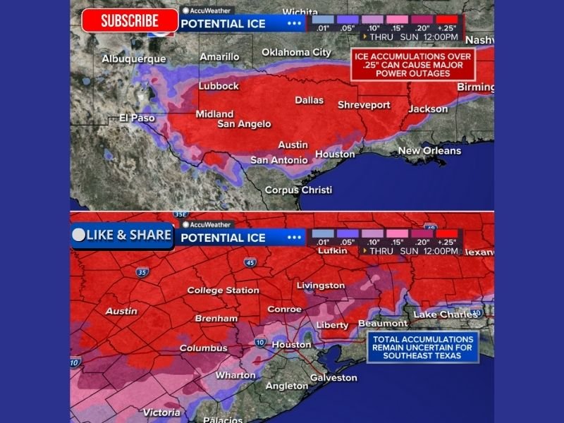
Quarter-Inch Ice Threshold Signals Major Impacts
Meteorologists warn that just 0.25 inches of ice can trigger major disruptions, and current forecasts suggest large portions of Texas may exceed this threshold.
Ice at this level dramatically increases the weight on infrastructure, stressing poles, lines, and trees. Once that threshold is crossed, outages often become widespread rather than isolated, especially when icing spans multiple counties.
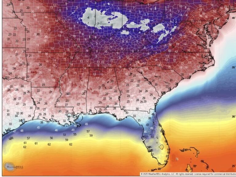
Freeze Line Uncertainty Creates High-Risk Scenarios
One of the largest uncertainties remains the exact placement of the freeze line during peak precipitation. In a best-case scenario, areas from Houston to the immediate Gulf Coast may remain just warm enough for cold rain, avoiding significant icing.
However, forecasters caution that a southward shift of the freeze line could result in significant icing across Southeast Texas, including major population centers, leading to widespread power outages and hazardous travel.
Southeast Texas Faces the Greatest Uncertainty
Forecast maps show potentially significant ice accumulation across Central and Southeast Texas, though exact totals remain uncertain. Small temperature changes could mean the difference between cold rain and damaging ice accretion, making this region particularly vulnerable.
Meteorologists expect greater clarity on freeze-line placement as additional data arrives, but stress that residents should prepare for high-impact outcomes rather than focusing on precise totals.
Travel and Power Disruptions Increasingly Likely
If freezing rain verifies as expected, road conditions could deteriorate rapidly, especially on bridges and elevated roadways. Ice accumulation also raises the risk of downed power lines and blocked roadways, which can delay emergency response and utility restoration.
Officials urge residents to avoid unnecessary travel once freezing rain begins and to prepare for the possibility of extended power interruptions.
Residents Urged to Prepare Ahead of the Weekend
Emergency planners recommend Texans prepare now, including securing food, water, medications, and backup heating options, and ensuring pets and vulnerable neighbors are protected. Forecasters emphasize that preparation is about risk reduction, not alarm, as the situation continues to evolve.
If you live in Texas, especially in areas prone to ice storms, how are you preparing for the potential impacts of this system? Share your thoughts and experiences with the SaludaStandard-Sentinel.com community.