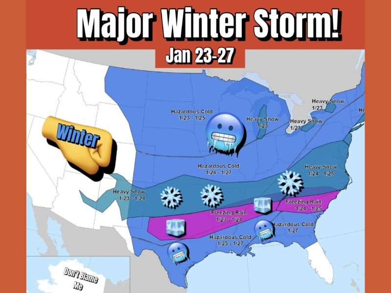
Texas, Oklahoma, Arkansas, Tennessee, Kentucky, and the Carolinas Brace for Major Multi-Day Winter Storm Bringing Hazardous Cold, Heavy Snow, and Freezing Rain
UNITED STATES — A powerful and far-reaching winter storm is expected to impact Texas, Oklahoma, Arkansas, Tennessee, Kentucky, and the Carolinas beginning Friday and continuing through January 27, with hazardous Arctic cold, heavy snow, and freezing rain forecast across a large portion of the country.
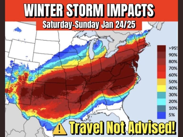
Widespread Winter Storm to Affect More Than Half the Nation
Meteorologists warn this system is notable not just for intensity, but for sheer geographic coverage, with impacts stretching from the Southern Plains to the Southeast and Mid-Atlantic. Forecast maps show multiple hazards unfolding simultaneously, placing more than half of the United States under some form of winter weather risk.
This type of expansive storm increases strain on travel networks, power infrastructure, and emergency services, particularly as impacts overlap across several days.
Dangerous Arctic Cold to Dominate the Central and Southern States
A surge of dangerously cold Arctic air will overspread much of the central U.S., with hazardous cold conditions expected from January 23 through January 27. Daytime highs may remain well below normal, while overnight lows could reach life-threatening levels, especially in areas unfamiliar with prolonged cold.
Officials caution that extended exposure could lead to frozen pipes, vehicle failures, and increased risk of hypothermia, particularly for vulnerable populations.
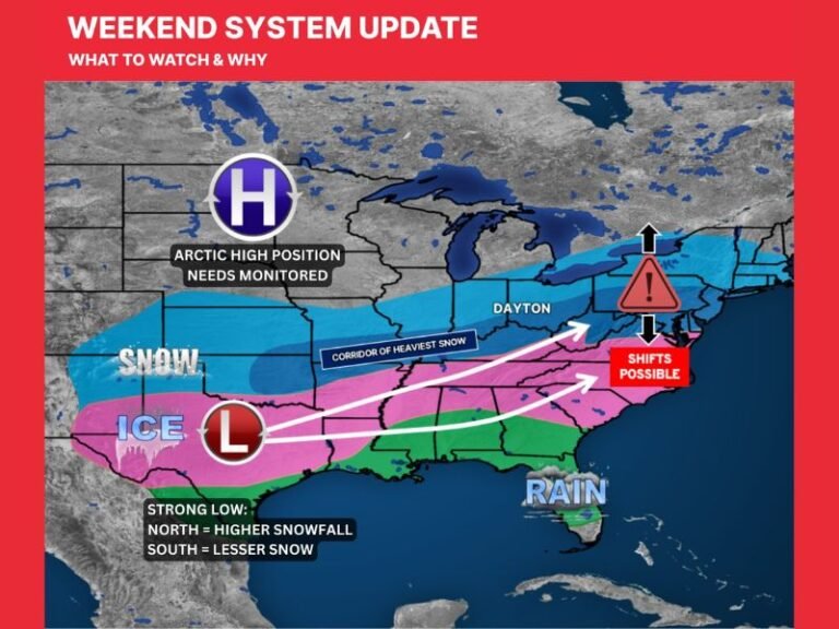
Heavy Snow Zone Extends From the Plains to the Appalachians
Forecast guidance shows a wide swath of heavy snow developing from portions of Texas and Oklahoma through Arkansas, Tennessee, Kentucky, and into the Appalachian region. In some areas, snow may persist over multiple days, increasing the likelihood of impassable roads, flight cancellations, and school closures.
Snowfall of this magnitude across southern and central states is especially disruptive due to limited snow-removal resources and infrastructure not designed for repeated winter events.
Significant Freezing Rain Threat Across the Deep South
Perhaps the most dangerous component of this storm is the corridor of freezing rain expected across parts of the Deep South, where ice accumulation could be substantial. Ice poses a severe risk to power lines, trees, and roadways, often resulting in widespread and prolonged power outages.
Meteorologists emphasize that even moderate ice accumulation can cause more damage than heavy snow, especially when combined with gusty winds and saturated soils.
Extended Timeline Raises Risk of Compounding Impacts
Unlike short-lived winter events, this storm is expected to unfold over several days, increasing the likelihood of compounding impacts such as refreezing, infrastructure fatigue, and delayed recovery efforts.
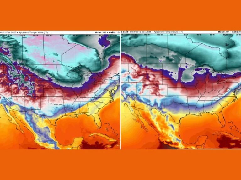
Forecast confidence is high in the overall pattern, though exact snowfall and ice totals will continue to evolve as the storm approaches.
Residents Urged to Prepare Before Conditions Deteriorate
Emergency officials urge residents across affected states to prepare ahead of time, including securing food, heating resources, and backup power options, and ensuring pets and livestock are protected from extreme cold.
Preparation is advised as a precautionary step, not a cause for panic, as updated forecasts will continue to refine local impacts. If your area is expected to experience this winter storm, how are you preparing for the cold, snow, or ice? Share your plans and experiences with the SaludaStandard-Sentinel.com community.