High-Impact Southern Winter Storm Signal Emerges as Snow, Ice, and Travel-Crippling Conditions Threaten Multiple States This Weekend
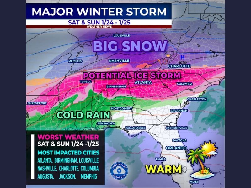
UNITED STATES — A significant winter storm is increasingly likely to impact a wide swath of the southern United States next weekend, with forecast data pointing to a dangerous combination of heavy snow on the northern side of the system and a potentially crippling ice storm across central and southern portions of the region.
Meteorologists stress that this is not a typical cold rain setup. Instead, the evolving pattern shows classic ingredients for major winter impacts, particularly in parts of the Deep South and Southeast that are historically vulnerable to ice.
Broad Storm Structure Shows Snow North, Ice South
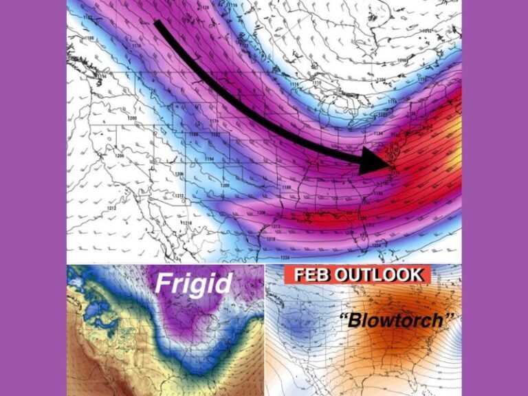
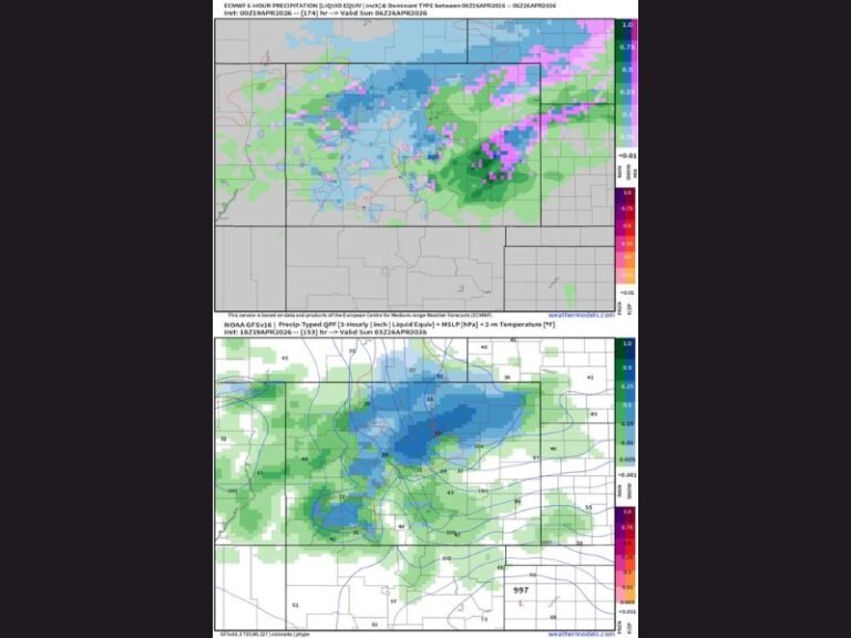
Current forecast guidance depicts a large, organized winter storm spreading eastward across the South late Saturday into Sunday. On the colder, northern side of the system, significant snowfall is possible, while just to the south, a narrow but dangerous zone of freezing rain and sleet could develop.
This transition zone is where impacts often become most severe, especially when surface temperatures hover near freezing while warmer air rides overhead — a setup that favors glazing ice rather than snow.
Atlanta, Birmingham, Charlotte, and Raleigh in the Ice Danger Zone
Several major cities sit directly within the highest-risk ice corridor, including:
- Atlanta, Georgia
- Birmingham, Alabama
- Charlotte, North Carolina
- Raleigh, North Carolina
If this setup verifies, travel could become extremely hazardous, with ice quickly coating roads, bridges, and overpasses. Power outages are also a growing concern, as even modest ice accumulations can down trees and power lines in the Southeast.
Forecasters emphasize that impacts in the Sunbelt can be outsized, even when ice totals do not appear historic on paper, due to limited treatment infrastructure and lower public familiarity with icy conditions.
Snow Potential Increases North of the Ice Band
North of the freezing rain zone, colder air looks deep enough to support meaningful snowfall, particularly across parts of Tennessee, Kentucky, and surrounding areas. Cities such as Louisville, Nashville, and Memphis are being closely monitored for accumulating snow that could further complicate regional travel.
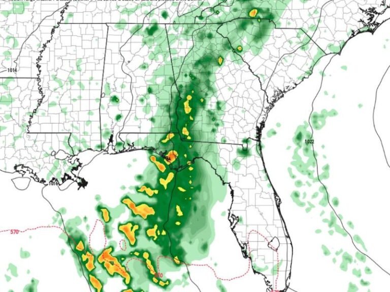
Florida Likely Spared as Warm Air Holds Firm
While much of the South braces for winter weather, Florida appears likely to escape the storm’s worst impacts, with forecast warmth keeping precipitation in liquid form — and in some areas, temperatures climbing well above normal. This sharp temperature contrast highlights just how tight and volatile the storm’s gradient may be.
Why This Storm Deserves Early Respect
This potential event stands out because of its scale and structure, not just raw precipitation amounts. Ice storms in the Southeast are notoriously disruptive, and even small forecast shifts could dramatically change who sees snow versus ice.
Meteorologists caution that details will continue to evolve, but confidence is growing that some form of high-impact winter weather will occur across the region next weekend.
What Residents Should Do Now
With several days still remaining, now is the time to review winter preparedness plans, especially in ice-prone areas. Residents should be ready for:
- Dangerous travel conditions
- Possible road closures
- Power outages lasting hours or longer
- Rapid changes in forecast details
Bottom Line
A major southern winter storm is increasingly possible next weekend, featuring heavy snow to the north and a serious ice storm threat across parts of Alabama, Georgia, and the Carolinas. While exact impacts are not yet locked in, this is a setup that warrants close attention.
Stay with SaludaStandard-Sentinel.com for continued updates, refined impact zones, and preparedness guidance as confidence in this winter storm continues to grow.