North Carolina and South Carolina Face Uncertain Snow Threat as GFS Model Signals Arctic Air but Forecasters Urge Caution
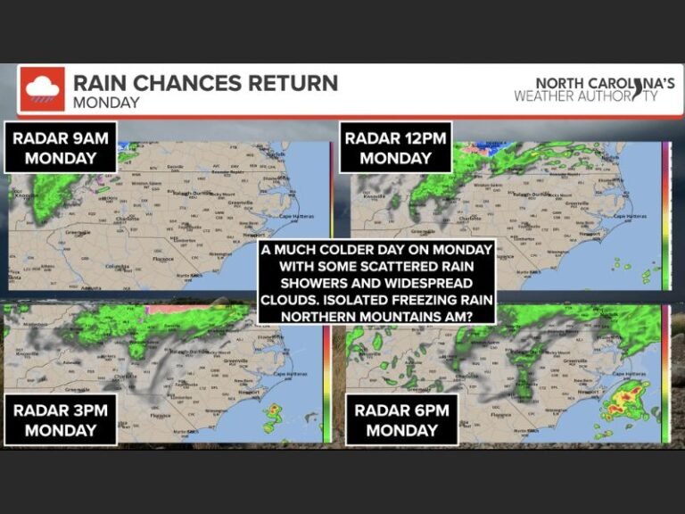
NORTH CAROLINA / SOUTH CAROLINA — A new run of the Global Forecast System (GFS) model has sparked widespread online buzz after indicating a potential snow event across the Carolinas next week, but meteorologists are urging residents to slow down and separate early signals from confirmed forecasts. While the broader weather pattern does support colder and stormier conditions, experts say it is far too early to declare a significant snowstorm.
What the Latest GFS Model Is Showing
The newest GFS data introduces a scenario in which Arctic air moves southward in multiple waves, potentially interacting with a developing storm system. Under the right conditions, that interaction could produce snow across parts of North Carolina and South Carolina. However, forecasters emphasize that this is one model run, not a locked-in outcome. Computer models frequently show dramatic solutions at long range that never materialize once timing and storm tracks become clearer.
Why Meteorologists Are Pumping the Brakes
While both the American GFS and European models have hinted at snow signals at times, weather experts stress that no specific storm track, snowfall totals, or impact zones can be confidently identified yet. What forecasters are watching is the pattern, not the storm itself. The presence of cold air alone does not guarantee snow. The timing must align precisely with moisture and storm development, something that remains highly uncertain at this stage.
Arctic Air Is the Signal, Not the Forecast
Meteorologists say the real takeaway from the data is the continued presence of strong Arctic air surges. If one of those cold waves coincides with the right storm system, winter weather could develop quickly.
For now, that possibility remains conditional. Experts caution that early snow maps circulating online are speculative and should not be treated as predictions.
Why One Model Run Is Not Enough
Weather professionals repeatedly warn that a single GFS run does not make a storm. Long-range models often fluctuate dramatically from day to day, especially during active winter patterns. Forecasters plan to compare upcoming GFS updates with European model data and ensemble guidance before drawing conclusions. Until consistency appears across multiple runs, confidence remains low.
What Residents in the Carolinas Should Do Now
At this stage, officials recommend staying informed but avoiding overreaction. There is no confirmed snowstorm, no advisories, and no emergency actions needed at this time. Residents should be aware that winter is not finished and that conditions can change quickly, but they should also be cautious about sharing or believing exaggerated claims circulating on social media.
The weather pattern supports cold air and the potential for winter weather, but there is no locked-in snow event for the Carolinas. Meteorologists say attention should remain on upcoming model trends rather than any single dramatic forecast graphic. More clarity is expected as the system draws closer and forecasting confidence improves.
Are you watching for snow in the Carolinas — or just following the forecast debate? Share your thoughts and stay updated with trusted regional weather coverage at SaludaStandard-Sentinel.com.