Mid-January Winter Pattern Signals Snow and Cold Risk for Texas, Louisiana, Arkansas, Mississippi, Tennessee, Alabama, and Kentucky
ALABAMA — A developing mid-January winter pattern is drawing attention across the South as long-range European weather model data suggests renewed cold air and accumulating snow potential could return between January 12 and January 15, even after recent springlike conditions across the region.
Forecast guidance indicates that winter may not be finished yet, particularly for parts of the Lower Mississippi Valley, Tennessee Valley, and southern Plains, where colder air could push southward and interact with lingering moisture.
Long-Range Model Signals Point to Winter’s Return
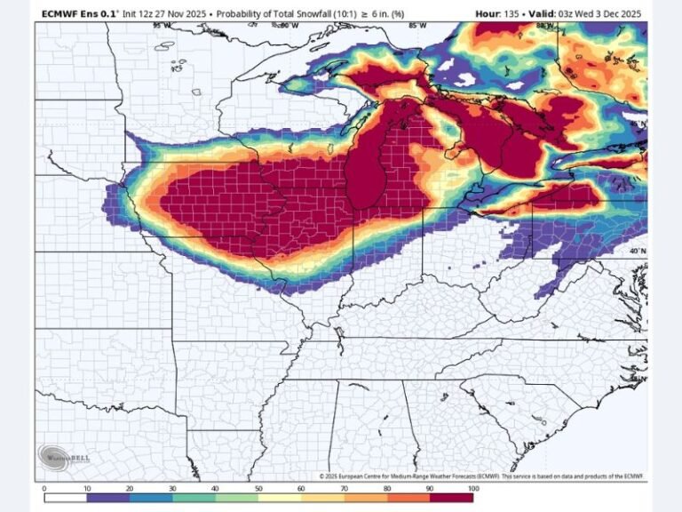
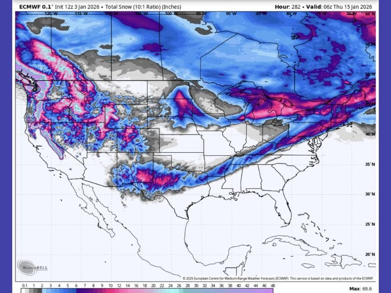
The latest European (ECMWF) model run shows a broad swath of snow potential stretching from Texas through the Mid-South and into the Ohio Valley, suggesting a pattern shift that contrasts sharply with recent mild weather. While this data remains long-range and not yet locked in, the consistency of colder signals returning in mid-January raises concern for travel disruptions, icy conditions, and sudden temperature drops across several southern states.
States That Could See Impacts If the Pattern Holds
Based on current model projections, the areas showing the strongest signal for snow or wintry precipitation include Texas, Louisiana, Arkansas, Mississippi, Tennessee, northwestern Alabama, and Kentucky.
The model highlights potential snow bands cutting across these regions, indicating that winter weather could affect areas not accustomed to mid-January snowfall, especially if surface temperatures fall quickly after sunset.
Why This Setup Matters Despite the Long Range
Forecasters emphasize that while this is not yet an official forecast, it serves as a warning shot that winter patterns may reassert themselves after a temporary warm spell. Such setups have historically produced rapid changes, where confidence increases only days before impact, leaving limited preparation time for residents and transportation officials across the South.
Temperature Whiplash and Public Complacency Concerns
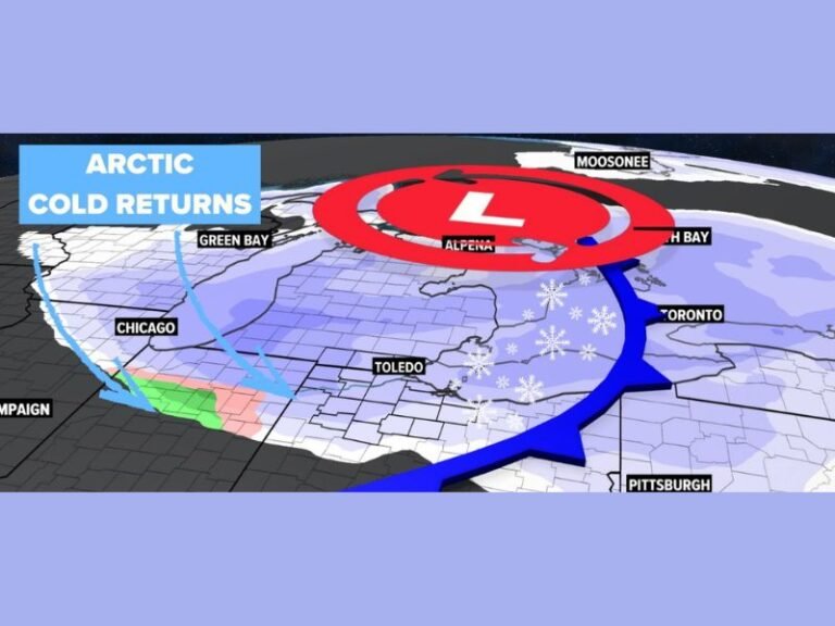
Recent warmth has led many to believe that winter is finished, but meteorologists caution against complacency. Cold air masses can still surge south in January, especially when jet stream patterns realign.
If this pattern evolves as projected, residents could experience sharp temperature drops, freezing overnight lows, and accumulating snow, even in areas that recently felt springlike.
What Residents Should Do Now
Officials stress that this outlook should be used for awareness rather than panic. The key takeaway is that winter weather remains possible, and conditions may change rapidly as January progresses. Residents across the impacted states are encouraged to monitor updated forecasts, prepare vehicles and homes for colder conditions, and avoid dismissing winter threats based solely on recent warmth.
Have you already packed away winter gear, or are you keeping it close just in case? Share your thoughts and stay informed with continued weather coverage at SaludaStandard-Sentinel.com.