Washington Coast Faces Significant Coastal Flooding Risk This Weekend as Rare Triple-Gravitational Alignment Coincides With Incoming Storm
WASHINGTON — Coastal communities along Washington state are facing an elevated risk of significant coastal flooding this weekend as an unusual alignment of astronomical forces coincides with a passing storm system, pushing tides higher than normal along the shoreline. Forecasters say the threat is primarily tied to tidal flooding, not rainfall, with the highest impacts expected during peak high tides Saturday and Sunday.
Rare Triple Gravitational Alignment Driving Higher Tides
The primary driver of this weekend’s flooding risk is a rare triple gravitational alignment involving the Sun, Moon, and Earth. The weekend coincides with a full moon, a supermoon (when the Moon is at its closest point to Earth), and Earth’s closest annual point to the Sun, which occurs in early January. Each of these factors slightly increases gravitational pull on Earth’s oceans. Combined, they produce higher-than-average king tides, leaving coastal areas more vulnerable to flooding.
Incoming Storm Adds Additional Stress to Already High Tides
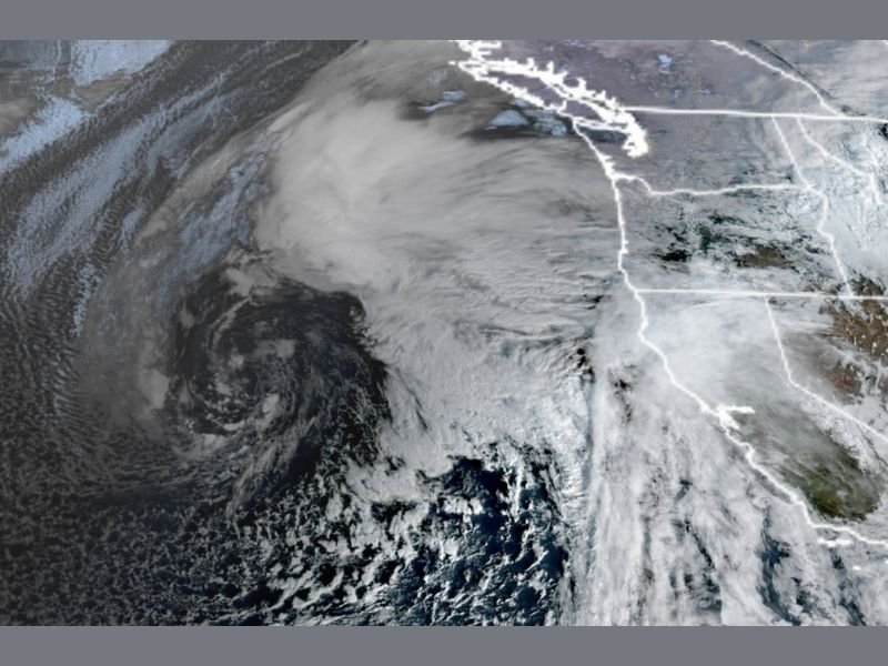
With tides already running elevated, an approaching Pacific storm is expected to add additional pressure. While the storm itself is not extreme, lower atmospheric pressure can gently lift sea levels, and onshore winds may push water toward the coast. Individually, these effects are often minor. Together, they can raise water levels enough to trigger flooding in low-lying coastal areas.
Coastal Flood Warnings Issued for Washington Shorelines
The National Weather Service has issued Coastal Flood Warnings for parts of the Washington coast, including Westport and Grays Harbor County, where flooding of 2 to 2.5 feet above ground level is possible during high tide periods. A Coastal Flood Watch is also in effect for portions of the North Coast, with potential for 2.5 to 3 feet of coastal flooding in vulnerable shoreline and low-lying areas.
Road Closures and Property Impacts Possible
Officials warn that numerous coastal roads may be closed during peak high tide periods. Low-lying homes, businesses, and some critical infrastructure could experience inundation, and shoreline erosion is also possible. High tide peaks are expected around the 12–1 a.m. and 12–1 p.m. time frames on both Saturday and Sunday, when flooding risk will be highest.
Inland Waters May See Minor Tidal Flooding
While rainfall is not expected to cause river or urban flooding, tidal flooding may extend into inland waters, including parts of Puget Sound and the Salish Sea shoreline. These impacts are expected to remain localized but could affect waterfront roads and marinas.
Winds and Weather Impacts Expected to Remain Limited
Beyond tidal concerns, weather conditions across western Washington are expected to remain relatively typical for early January. Gusty winds may increase late Saturday night into Sunday morning, with gusts generally expected to peak around 30–35 mph, and isolated coastal gusts potentially reaching 40–45 mph.
Forecast models suggest winds should remain below damaging levels, and the storm is not expected to produce significant mountain snow due to mild temperatures.
What Comes Next
The storm system is expected to weaken as it moves inland Sunday, allowing tidal impacts to gradually ease. Another cooler system may approach early next week, potentially bringing better mountain snow chances, though it does not appear connected to this weekend’s flooding threat.
Residents along Washington’s coast are urged to plan travel carefully around high tide times and remain alert to local advisories. If you live in a coastal or shoreline community and experience tidal flooding this weekend, share your observations and stay informed with continued coverage from SaludaStandard-Sentinel.com.

