Midwest and Northeast Brace for High-Impact Winter Storm Driven by Extreme Atmospheric Pressure Imbalance and Rapid Temperature Swings
MIDWEST & NORTHEAST — A major winter system is lining up to sweep from the Midwest into the Northeast, bringing high winds, rapid pressure drops, heavy rain, snow, and sudden temperature swings. Meteorologists warn that this storm is not just another weather event but a pressure-release system fueled by an overstressed atmosphere that has not reset for weeks.
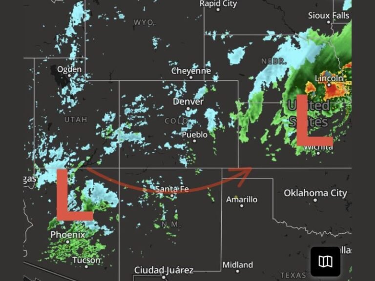
Storm Triggered by Stacked Atmospheric Pressure and Jet Stream Displacement
Experts say the region has been experiencing a highly displaced jet stream, allowing warm air to surge north while bitter Arctic air repeatedly collapses south. This has created tightened pressure gradients, which haven’t relaxed between recent storm systems.
According to the analysis, that built-up pressure must release somewhere — and when it does, it produces wind-driven storms rather than ordinary snow events. This stacked pattern explains why the Midwest and Northeast have seen back-to-back systems without recovery time.
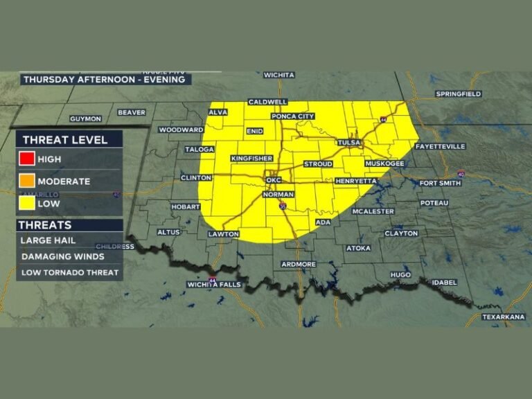
Wind Damage Becomes a Major Concern Ahead of Snow and Ice
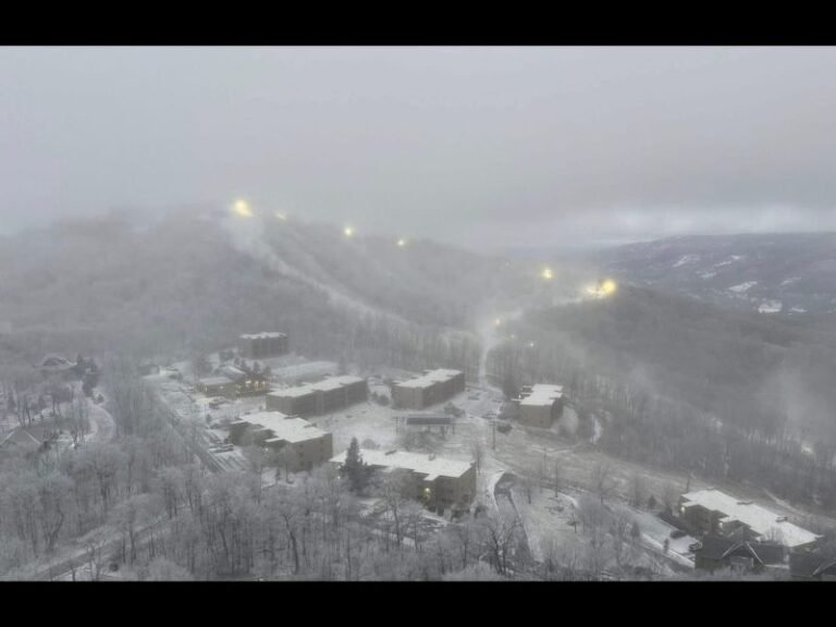
Meteorologists emphasize that wind will be as dangerous as precipitation. Frozen and thawed ground weakens tree roots, and leafless winter trees act like sails, making them more vulnerable to 50+ mph gusts. Infrastructure across the region is already strained from earlier storms, meaning even routine systems may cause outsized damage.
This storm is expected to bring:
- Rapid pressure drops
- Sudden wind shifts
- Rain changing to snow or ice
- Flash-freeze conditions behind the storm
These conditions could lead to dangerous travel scenarios as the system moves across the Midwest and into the Northeast.
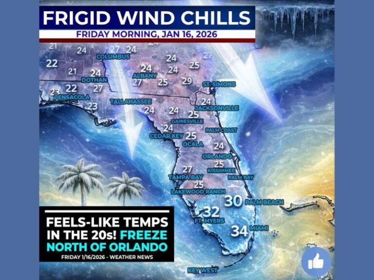
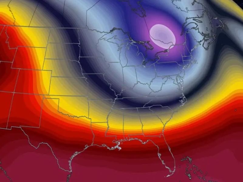
Extreme Temperature Contrasts Are Fueling the Storm
Maps released by atmospheric analysts show a dramatic contrast between warm southern air and deeply cold Arctic air plunging south across the Great Lakes and Northeast. This temperature clash acts as an energy source, accelerating storm development and intensifying wind fields.
Weather officials note that the current setup resembles a pressure-release valve, where the atmosphere offloads stress through fast-forming, high-impact storm systems.
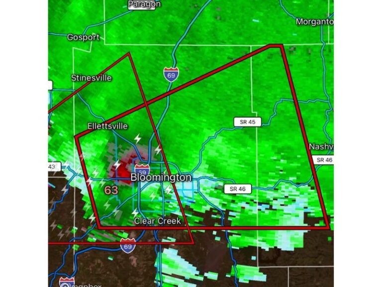
Hazards Expected From Midwest to the Northeast
From Chicago to Cleveland and into New York and New England, residents may see a mix of:
- Strong winds capable of tree damage
- Heavy rain changing rapidly to snow
- Icy conditions from sudden temperature drops
- Hazardous road conditions and reduced visibility
Meteorologists warn that significant impacts may occur even if snowfall totals are not extreme, because the danger comes from stacked stress, weakened infrastructure, and unstable ground conditions.
Residents across the Midwest and Northeast are encouraged to monitor local forecasts closely, stay cautious during high-wind periods, and share storm observations with SaludaStandard-Sentinel.com as the system evolves.