Oregon and Washington Brace for Major Flooding Threat as Powerful Atmospheric River Targets Pacific Northwest
OREGON — A powerful atmospheric river system is bearing down on the Pacific Northwest, threatening extreme rainfall, flooding, and landslides across western Oregon and Washington over the next 72 hours.
Meteorologists warn this is not a routine storm. Forecast models show a dense “sky river” of Pacific moisture aimed directly at the already-saturated coastline — a setup that could deliver 10 to 12 inches of rain in localized areas by Friday afternoon, particularly south of Portland and through the Willamette Valley. Satellite imagery shows an expansive band of moisture stretching thousands of miles from the central Pacific Ocean, feeding directly into the coast — a signature feature of a high-impact atmospheric river event.
Heavy Rainfall and Flooding Expected Across Oregon and Washington
Western Oregon and southwest Washington are forecast to see the heaviest rainfall totals, with intense downpours developing late Wednesday night and persisting through Friday.
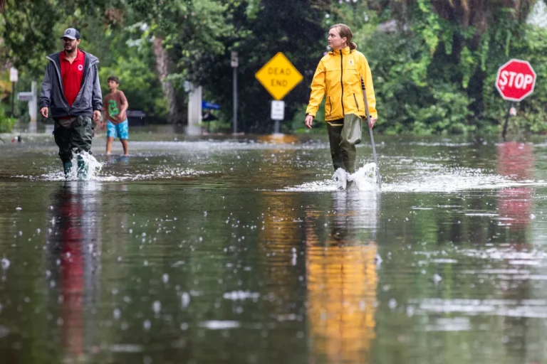
Communities near Silverton, Eugene, Salem, and parts of western Washington’s coastal ranges could face localized flooding and rapid creek and river rises.
“This system still has a lot of energy behind it,” forecasters said. “Because the ground is already saturated from previous storms, even moderate rainfall could quickly lead to flash flooding and mudslides.”
Why the Setup Is Dangerous
This latest system is the third in a series of storms to hit the Pacific Northwest this month, compounding the flooding threat. Meteorologists highlight several concerning factors:
- The ground is already soaked from recent rainfall.
- Rivers and creeks are running high before new rain arrives.
- The moisture plume is long-lasting and densely concentrated.
- The jet stream is locked in a position that continuously feeds moisture into the same regions.
This combination raises the likelihood of rapid runoff, landslides, and flooded low-lying roads, especially in valleys and foothill zones west of the Cascades.
Localized Impacts and Safety Warnings
Emergency officials are urging residents in western Oregon and western Washington to take immediate precautions.
Key safety measures include:
- Monitoring river gauges and local alerts daily.
- Avoiding low-lying and flood-prone roads during heavy rainfall.
- Preparing for possible power outages as saturated soils could bring down trees.
- Staying alert near creeks, hillsides, and saturated slopes, where landslides could develop quickly.
“When these atmospheric rivers stack one after another, it’s not just the rain you worry about — it’s what happens after,” said a meteorologist tracking the event. “The water has nowhere left to go.”
Atmospheric River Still Intensifying
Satellite data and model guidance indicate the system could intensify as it nears the Oregon coast, with a steady stream of subtropical moisture extending from near Hawaii into the Pacific Northwest — a phenomenon often referred to as the “Pineapple Express.”
Rainfall rates could exceed one inch per hour at times, especially in coastal and mountainous regions, where orographic lift enhances precipitation totals.
Outlook
By late Friday, the system is expected to gradually weaken as it shifts inland, but scattered showers will continue into the weekend.
Rivers may remain elevated into Saturday and Sunday, prolonging the risk of flooding in the Willamette Valley and southwestern Washington. Residents across the Pacific Northwest are advised to remain vigilant and prepared as the storm unfolds. Stay updated with flood alerts and emergency advisories at SaludaStandard-Sentinel.com.


