Dangerous Wind Chill Event Expected to Hit Texas, Louisiana, Mississippi, Alabama, Georgia, Tennessee, the Carolinas, and Florida With Extreme “Feel-Like” Temperatures Early Monday
TEXAS — A major and widespread wind chill event is expected early Monday morning across Texas, Louisiana, Mississippi, Alabama, Georgia, Tennessee, the Carolinas, and Florida, with forecast models showing dangerously low “feel-like” temperatures across the entire region. Meteorologists warn that the combined effect of Arctic air and strong winds could produce some of the most extreme wind chills of the season, impacting tens of millions before sunrise.
All Major Weather Models Agree on a Deep, Rapid Drop in Wind Chill
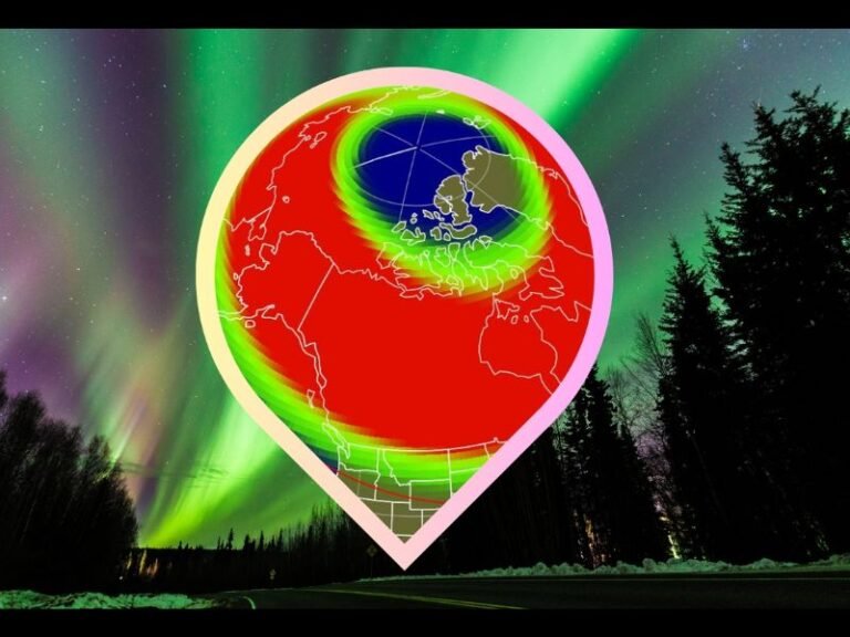
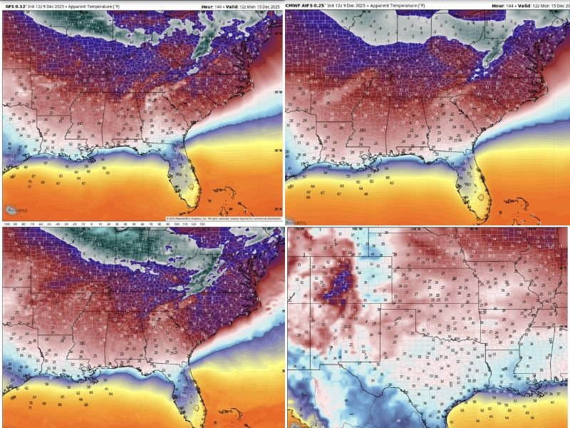
Forecast data analyzed from the GFS, EURO, and EURO AI-enhanced models shows an uncommon level of agreement: wind chills across the South will fall sharply into the teens and single digits, with some areas plunging even lower. This rare consistency among all three major models strongly indicates a high-confidence Arctic surge.
Weather maps show:
• Texas: widespread wind chills in the 20s and teens, with colder pockets in northern regions
• Louisiana and Mississippi: wind chills falling into the teens and low 20s
• Alabama and Georgia: widespread teens and even lower values in exposed areas
• Tennessee: the most severe conditions, with single-digit wind chills in many regions
• Carolinas: sharp drops into the teens with potentially lower readings in the mountains
• North Florida: wind chills expected in the 30s and upper 20s, unusually low for the region
Meteorologists note that the entire stretch from Texas to the Carolinas will experience well-below-normal apparent temperatures, with some areas feeling more like the middle of January than early December.
Texas, Louisiana, and Mississippi: Wind Chill Drops Expected to Cause Rapid Discomfort
In Texas, despite higher actual temperatures, the wind chill will create much colder “feel-like” values, especially before sunrise. Residents could feel conditions equivalent to the low 20s, and exposure may become uncomfortable within minutes.
In Louisiana, expected wind chills will be cold enough to impact morning commutes, cause stinging skin exposure, and create hazardous conditions for anyone outdoors for extended periods.
Mississippi is forecast to see some of the fastest drops in wind chill nationwide. Residents stepping outside early Monday may feel immediate discomfort as wind chills rapidly fall into the teens.
Alabama, Georgia, and Tennessee Forecast to Face the Most Severe Cold
Alabama is projected to experience wind chills that could cause instant discomfort and limited visibility from tearing eyes, especially during morning travel. Many areas may feel temperatures hovering in the low teens.
Georgia, including the Atlanta metro, will experience unusually intense wind chill values. Forecast maps show the region falling into the upper teens, with some isolated locations feeling even colder due to elevation and exposure.
Tennessee is expected to endure the most extreme wind chills in the region. Model guidance indicates widespread values in the single digits, making early morning exposure potentially hazardous, particularly for vulnerable populations.
Carolinas and Florida: Unusually Cold Air Will Push Deep Into the Region
The Carolinas will feel a sharp, intense wind chill plunge, with forecast maps showing teens and low 20s across much of both states. Mountain regions could see “feel-like” temperatures near or below the single digits.
Even Florida will not escape the cold intrusion. Northern Florida is expected to feel wind chills in the upper 20s to low 30s, a level of cold seldom experienced at this time of year.
Meteorologists emphasize that when all three major models agree, it signals a significant weather event with a high degree of certainty.
Preparing for Monday Morning’s Wind Chill Hazard
Residents across all impacted states should take extra precautions:
• Limit early-morning outdoor exposure where possible
• Dress in layers and cover exposed skin to avoid discomfort or minor frostbite
• Protect pets and livestock from rapid heat loss
• Prepare vehicles for difficult starts in colder regions
• Use caution on roadways where strong winds and cold air may reduce visibility or response time
The upcoming wind chill surge represents a region-wide weather hazard, spanning from Texas to the Atlantic coast and through Florida. Residents are encouraged to monitor updated forecasts and share local weather impacts with SaludaStandard-Sentinel.com as this Arctic-influenced system arrives.