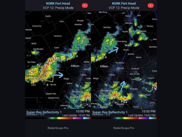
Rapid-Fire Alberta Clippers Set to Sweep Across the Midwest and Northeast With Multiple Rounds of Snow Next Week
UNITED STATES — A train of fast-moving Alberta Clippers is preparing to sweep across the Midwest and Northeast, bringing repeated rounds of snow, shifting weather patterns, and the potential for a few systems to intensify into more meaningful storms. Forecasters say these quick-hitting disturbances may arrive every 24–36 hours, creating an active stretch of winter weather through the upcoming week.
What Alberta Clippers Are and Why They Matter This Week
Alberta Clippers are compact low-pressure systems that originate in the high plains of Alberta, Canada. These systems dive southeast on the northern jet stream, pulling in cold, dry Canadian air and producing bursts of light, powdery snow. Typically, clippers are known for quick hits and quick exits, but forecasters caution that a few may interact with Atlantic moisture, allowing them to slow down and strengthen as they move toward the Mid-Atlantic and Northeast.
This coming week’s pattern supports a full series of clipper systems, each with its own timing and intensity. While many clippers bring only light snow, meteorologists note that any single wave can deepen unexpectedly, producing more significant accumulations if conditions align.
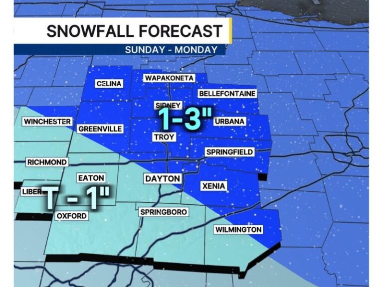
Snowfall Expectations Across the Midwest and Northeast
Early projections show a broad swath of light snow covering large parts of the Midwest and Northeast. According to the snowfall outlook, widespread general light snow is likely across states including Ohio, Pennsylvania, New York, Michigan, and New England. Certain regions are highlighted for 1–3 inches of snow per system, with enhanced zones shown on the snowfall probability map.
Farther south, including areas near the Ohio River Valley and parts of the Mid-Atlantic, some systems may bring mixed precipitation as surface temperatures hover near freezing. With several waves expected, small shifts in track could lead to frequent snowfall adjustments, making the forecast highly variable from one system to the next.
Forecasters emphasize that each clipper will have its own personality, meaning snowfall intensity and coverage will change rapidly throughout the week. Residents across the region should be prepared for frequent updates and quick-moving weather transitions.
Monitoring for Any Clipper That Slows Down and Strengthens
While many clippers remain weak and fleeting, forecasters always watch for the scenario where a system slows down and taps into Atlantic moisture. When this happens, a clipper can evolve into a more substantial snowmaker, producing heavier snow bands and more widespread impacts. Meteorologists will be watching each incoming wave for early signs of amplification or track shifts that could elevate impacts in the Northeast.
Have you experienced early signs of clipper activity in your area? Share your observations and stay connected with the latest winter updates at SaludaStandard-Sentinel.com.