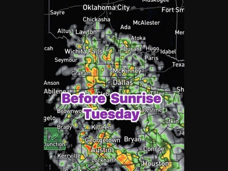
Freezing Drizzle and Sleet Expected Early Thursday Across Oklahoma, Creating Dangerous Morning Travel Conditions
OKLAHOMA CITY, OK — Drivers across northern and central Oklahoma should prepare for hazardous travel conditions early Thursday morning, as meteorologists warn of freezing drizzle and light sleet developing before sunrise. Temperatures will hover around 29°F to 32°F, creating ideal conditions for slick and icy roads — especially on bridges, overpasses, and untreated surfaces.
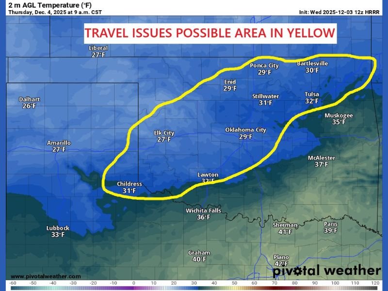
According to the latest HRRR model from Pivotal Weather, freezing precipitation is expected to begin forming around 4 a.m. Thursday in areas highlighted in yellow on the forecast map, including Oklahoma City, Tulsa, Stillwater, Enid, and Elk City. By 9 a.m., much of the affected region will still remain below freezing, raising concerns about commuter safety and potential roadway icing.
Freezing Drizzle and Sleet to Start Early
Forecasters say the first phase of the storm will start as light freezing drizzle, transitioning into sleet or light snow by mid-morning. While snowfall totals are expected to remain minor, the thin layer of ice from the drizzle could have a major impact on travel.
“Even a small amount of freezing drizzle can make roads extremely slick,” forecasters cautioned. “It doesn’t take much to turn a normal commute into a dangerous one.”
Cities from Ponca City and Bartlesville to Elk City and Oklahoma City are likely to experience sub-freezing surface temperatures through at least mid-morning, while areas farther south — including Lawton, McAlester, and Sherman, Texas — should stay above freezing.
Travel Impacts and Safety Precautions
Authorities are urging Oklahomans to avoid unnecessary travel Thursday morning if conditions worsen. Those who must be on the road are advised to:
- Reduce speed and increase following distance.
- Use extreme caution on bridges and overpasses, which freeze first.
- Allow extra time for travel during the morning commute.
- Monitor weather updates and local advisories before heading out.
The Oklahoma Department of Transportation (ODOT) is preparing to deploy salt and sanding trucks overnight to treat major highways and interstates ahead of the storm’s arrival. However, even treated roads may become slick quickly during the early hours.
Colder Air and Snow Showers to Follow
Behind the initial freezing drizzle, temperatures are expected to remain in the 20s and low 30s through Thursday morning before gradually climbing above freezing later in the day. A few lingering flurries or light snow showers may occur in northern Oklahoma before conditions improve by the afternoon.
While the system is relatively weak, it’s a classic early-winter setup capable of creating major morning travel headaches — especially since this will be one of the first widespread icing events of the season for Oklahoma.
Officials Monitoring Conditions Closely
Local agencies and meteorologists will continue to monitor conditions overnight. Drivers are encouraged to follow ODOT, the National Weather Service Norman office, and trusted local news outlets for real-time updates on travel safety.
Residents can also check live road maps and weather alerts at weather.gov/norman and okroads.org.
For ongoing winter weather updates and safety coverage, visit SaludaStandard-Sentinel.com.