South Faces Multiple Rounds of Heavy Rain and Storms This Week as La Niña Weather Pattern Strengthens
SOUTHEAST U.S. — A series of storm systems fueled by Gulf moisture and a strengthening La Niña pattern are expected to bring multiple rounds of rain and thunderstorms across the South this week, forecasters warn.
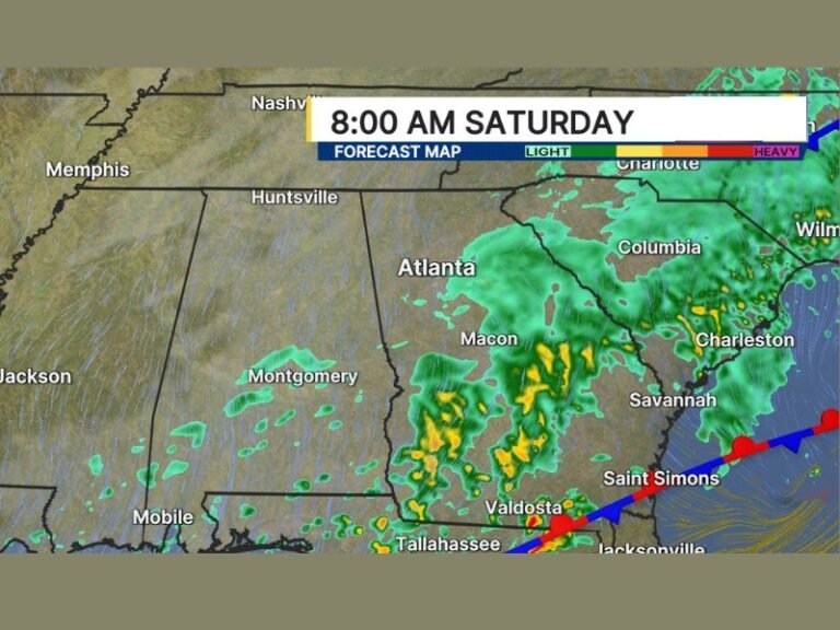
Weather models show a pattern of persistent wet conditions stretching from Texas and Louisiana through Alabama, Georgia, and the Carolinas, with storms likely to intensify at times between Saturday and next weekend.
La Niña Pattern Driving Active Weather
Meteorologists say the developing La Niña pattern is helping drive warmer air from the southern Gulf of Mexico into the central and eastern United States. This “southern fuel” is combining with an active jet stream, forming a horizontal flow of warm, moist air that’s triggering storms across several states.
The pattern is expected to remain in place through the week, allowing for repeated storm development — each system drawing in Gulf moisture before moving northeast.
Forecast models from SpaghettiModels.com highlight a triple wave pattern, with the first storm forming Saturday night, a second expected Tuesday morning, and another developing late next week.
Storm Timing and Expected Impacts
- Saturday Night into Sunday Morning:
The first wave of rain and thunderstorms will move through east Texas, Louisiana, and Mississippi, potentially bringing brief periods of heavy rain and gusty winds. - Tuesday Morning:
The second round looks more organized, with a broad line of rain and possible thunderstorms stretching from the Gulf Coast into Tennessee and the Carolinas. Rainfall rates could briefly exceed an inch per hour in some areas. - Next Saturday:
Another disturbance will approach from the west, bringing yet another round of rain to the Gulf states and lower Appalachians. Depending on temperatures, a few isolated strong storms can’t be ruled out.
While severe weather is not expected to be widespread, meteorologists caution that the repeated rainfall could lead to localized flooding in saturated areas, especially across low-lying parts of Mississippi, Alabama, and Georgia.
Weather Models Show Active Week Ahead
Maps provided by WeatherBell Analytics and SPC (Storm Prediction Center) show multiple clusters of precipitation forming in the South, fueled by warm Gulf air. The repeated nature of the storms — with short breaks between systems — may result in several inches of total rainfall by the end of the week.
“This is a pattern that tends to repeat,” a forecaster explained. “When La Niña sets up with a strong jet stream, the southern U.S. sees round after round of moisture pulling in from the Gulf. That’s exactly what we’re seeing this week.”
Preparedness and Safety
Drivers are urged to use caution, especially during morning commutes when rain bands are expected to move through the region. Motorists in flood-prone areas should avoid driving through standing water.
Residents are also encouraged to keep up with daily updates from the National Weather Service and local meteorologists, as forecast adjustments are likely as the storm tracks evolve.
The good news — temperatures will remain seasonably mild, avoiding any winter weather threats for now. However, the persistent rainfall and storm chances will dominate much of the upcoming week across the Southern and Mid-South regions.
Stay updated with daily regional forecasts and severe weather alerts on SaludaStandard-Sentinel.com.


