Early December Weather Alert: GFS Model Hints at Possible Snow and Ice Across Oklahoma and North Texas
OKLAHOMA CITY, Okla. — A new GFS weather model is signaling a greater potential for frozen precipitation early next month, raising the possibility of snow and ice across parts of Oklahoma, North Texas, and southern Kansas as Arctic air pushes southward to start December.
While it’s too early to lock in specifics, early data points to an active weather setup that could bring a wintry mix of snow, sleet, and freezing rain to several central U.S. states around December 2.
Arctic Blast Could Usher in Frozen Precipitation
Meteorologists are monitoring a strong cold front expected to drop temperatures rapidly late next week. As warm, moist air from the Gulf collides with the advancing Arctic air, models show the potential for freezing rain and snow bands forming along the boundary.
“It’s still early in the forecasting window, but the signal for a wintry pattern is there,” forecasters explained. “We’re watching for overlapping zones of moisture and cold air — the key ingredients for snow or ice.”
Regions Most at Risk
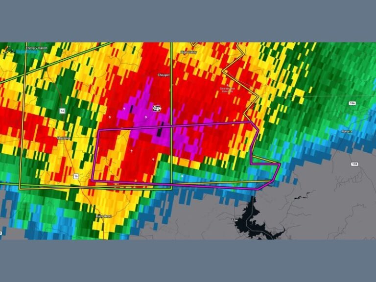
According to the latest GFS model projection, the heaviest snow may fall across northwest Oklahoma and southern Kansas, with mixed precipitation possible across central Oklahoma — including the Oklahoma City metro area — and stretching down into Wichita Falls and North Texas.
Cities that could see impacts if trends hold include:
- Oklahoma City, OK
- Tulsa, OK
- Lawton, OK
- Wichita Falls, TX
- Amarillo, TX
- Bartlesville, OK
- Lubbock, TX
Travel disruptions could become a concern if freezing rain or sleet develops, especially overnight into the morning of December 2.
Forecasters Urge Caution and Early Preparedness
Even though forecast confidence remains low, experts recommend staying weather-aware as the pattern evolves over the coming days.
Computer models can change significantly this far out, but early awareness helps residents prepare for potential travel delays, power outages, or road icing.
“The ingredients are aligning for a possible frozen precipitation event,” meteorologists said. “It’s too early to sound alarms, but it’s worth keeping a close eye on updates this week.”
What to Expect in Coming Days
- Timing: Dec. 1–3 window (subject to change)
- Precipitation type: Rain transitioning to sleet or snow in some areas
- Temperatures: Sharp drop behind Arctic front — lows in the 20s possible
- Hazards: Slippery roads, travel delays, icing risk on elevated surfaces
Residents across Oklahoma and North Texas are urged to monitor National Weather Service updates and prepare winter kits in vehicles ahead of any potential freeze event.
Stay informed and follow continuing updates on winter weather developments at SaludaStandard-Sentinel.com.